Thursday, August 7, 2014

38. Glacier County


The area bordering Canada and reaching east from the Continental Divide was originally part of Chouteau County (#19), and became part of Teton County (#31) when western Chouteau County was broken off.  In 1919, the state Legislature took the northern part of Teton County to create Glacier County.  The two main towns in the county were Cut Bank and Browning, and after a bitter fight, Cut Bank was chosen as the Seat.  It's important to note that by the time the Legislature created Glacier County, most of the land base for the county was outside the County's tax-base.  The Blackfeet Reservation, created by treaty in 1855 (before the creation of Montana Territory) and the eastern half of Glacier National Park (created in 1910) take up most of the land area of Glacier County.  Only a narrow strip of land bordering Toole County (#21) lies outside Federal or Tribal jurisdiction, a strip approximately eleven miles wide.  Or to put it another way, nearly 71% of the County's land area is within the Blackfeet Reservation and another 20.6% lies within Glacier National Park.  Not surprisingly, over 60% of the County's population is Native American.  The 2010 U.S. Census counted 13,399 county residents and the 2012 estimate of 13,711 is the highest population count in the County's history.


The Glacier County Courthouse
Cut Bank, Montana

The County Seat, Cut Bank, traces its history to the coming of the Great Northern Railroad in the 1890s.  It takes its name from Cut Bank Creek, one of the main water courses in the County, a stream which the Native folk called "the river that cuts into the white clay bank," according to the city's web site.  According to that same site, the city was originally located on the west side of the creek, but when it was discovered that the location was on Reservation land, the city fathers up and moved the town across the creek.  Today, the railroad bridge across the creek is one of the notable features of the local architectural landscape.

Rail Bridge across Cut Bank Creek

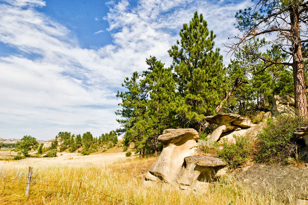
Based on the pictures above, one could reasonably conclude that Glacier County's topography is part of the Great Plains, flat to gently rolling land that stretches from the Canadian Rockies to the Mississippi River.  But we cannot forget that the County takes its name from Glacier National Park and the County extends west to the Continental Divide where it joins Flathead County (#7).  The western portion of the County is stunningly beautiful with countless vistas of mountains and lakes to capture the viewer's attention.  The Blackfeet called this area the Backbone of the World, and one of the common nicknames for Glacier National Park is the Crown of the Continent,  a phrase first used by George Bird Grinnell in 1901.  

The Siksika (Blackfoot) people are the largest population group in Glacier County.  An Algonquian speaking people, the Siksika are believed to have originated in the area north of the Great Lakes.  (There is considerable controversy over the English name of the tribe. Officially known as the Blackfeet Nation, tribal members point out that in their own language, the term is singular, not plural, and many use Blackfoot instead.  Rather than get into that battle, for the purposes of this essay, I shall use the term Siksika.)  In advance of European settlement, the Siksika moved westward and by the 1700s were living in what is now Saskatchewan.  By the 1800s, they were the dominant tribe in the northern plains, and their home territory reached westward to the Rocky Mountains and south to the Yellowstone River and beyond.  The Blackfeet Treaty of Fort Benton, signed in 1855 when Montana east of the Divide was known as Nebraska Territory, allocated almost two thirds of what is now eastern Montana to the Siksika people.  As has happened repeatedly in US/Native American relations, that reserved land has been taken time and again, and today's Blackfeet Reservation covers less than 1,500,000 acres, with over one third of that owned by non-Native people.  Note that the Blackfeet Reservation, unlike the Flathead Reservation west of the Divide, was never opened to non-Native settlement.  However, between 1907 and 1911, tribal lands were allotted to individual members, and those lands could be sold, and often were sold to non-Native people so that the original owners could have money to live on.  Today, the Tribe has first right of refusal allowing it to buy back reservation land being sold by non-Native land owners.  

Colorful Tipis at a private campground at St Mary's
Eastern edge of Glacier National Park
Unfortunately, these tipis, photographed in 2009 and not at all authentic, no longer exist

In 1896, the Tribe sold the western extent of its much reduced reservation for the sum of $1,500,000 with the intent that the land sold would be used for mineral exploration.  Fortunately, for us, not enough minerals were found to lead to the kind of land rush that has happened elsewhere under similar circumstances, and in 1910 this area was set aside as Glacier National Park.  The Great Northern Railroad built a series of hotels and chalets through the park with the goal of increasing tourism (and not-so-coincidentally rail travel revenues), and the railroad advertised the "Switzerland of America" heavily.  By the early 1930s, it became obvious that a road would need to be built through the mountains of the Park, and in 1932, Going-to-the-Sun Road was completed, connecting Apgar Village near West Glacier to Lake McDonald and St. Mary's on the eastern edge of the park, traversing 6,647 foot Logan Pass on its way across the park.  To this day, Going-to-the-Sun is the only road that crosses the Park, although U.S. Highway 2 connects West Glacier with East Glacier and follows the southern edge of the Park, with less than ten miles of the highway actually within the Park's borders.  In 1932, thanks to the efforts of people on both sides of the U.S./Canadian border, Glacier Park and the adjoining Waterton Lakes National Park in Alberta were connected under the name Waterton-Glacier International Peace Park.  This was the first international park in the world.  Today there are 170 such parks.  This is also the only place on the 5,525 mile U.S./Canadian border where you can cross the line without showing documentation.  (Note that I have never tried to enter Canada, or re-enter the U.S. by taking the boat trip across Waterton Lake.  Also note that should you try to enter the U.S. this way, you'll have a long hike from Goat Haunt at the southern end of the lake to any road or highway that will get you further into the U.S.)  

St Mary's Lake
Glacier National Park

Thursday, April 3, 2014

37. Daniels County


One of the most fascinating tidbits I've found while researching Montana counties is that according to an analytic tool called the Index of Relative Rurality(IRR), Daniels County, Montana, is the most rural county of all 3100 plus counties in the United States.  The county came into being on June 1, 1920, when the Legislature took a portion of northeastern Valley County (#20) and western Sheridan County (#34) to create the new entity which was named for a local rancher, Mansfield Daniels.  The county covers 1,427 square miles, almost all of which is dry land.  As of the 2010 U.S. Census, 1,751 people called Daniels County home.  As is so often the case in eastern Montana, the most recent Census is also the lowest population count in a county that has steadily lost population since it first appeared in the U.S. Census in 1930 when 5,553 people claimed it as their home.  Daniels County lies on the Canadian border, bordering the province of Saskatchewan.  Only Sheridan County (#34) separates Daniels from North Dakota.  Topographically, the land is rolling prairie, and the county has more ghost towns than actual thriving centers.  And if you're still pondering that "most rural county" status, it's based on, among other things: a) population; b) population density; c) extent of urbanized area; and d)  distance from a metropolitan area.  And no, I have no idea what c means.  As for d, Scobey, the Daniels County Seat, is 150 miles from Regina, Saskatchewan, 225 miles from Minot, North Dakota, and over 300 miles from Montana's largest city, Billings.  Let's just say that if you don't want to shop at the local market, you've got a fur piece to drive.


The Daniels County Court House
Scobey, Montana


The Daniels County Court House is pretty much what I expected to find in rural county seats around Montana.  To me, it looks like what an Old West county courthouse should.   In actuality, it's one of a kind, at least in Montana.  And we can't even call it the Old West.   Scobey got its first post office (and its name) in 1901, and the town wasn't incorporated until 1916.  As for its name, remember Mansfield Daniels, the rancher for whom the county is named?  He named the town after a friend of his, Maj. Charles Richardson Anderson Scobey, a cattleman in the Glendive area (Dawson County, #16).  Today over half the residents of Daniels County live in Scobey, where the 2010 U.S. Census counted 1,017 residents. There are two stories concerning the Courthouse building.  The sanitized version claims that it was originally the Commercial Hotel.  I prefer the story Don Spritzer tells in his Roadside History of Montana where he claims the building is the remodeled One-Eyed Mary's House of Pleasure. (p. 27)  I heartily recommend Spritzer's book where you can also read about Scobey's professional baseball team--recruited from the scandal ridden 1919 Chicago White Sox.

I have a personal connection to Scobey, albeit a rather tenuous one.  At the time my father was preparing to graduate from Seminary at Boston University, a District Superintendent from Montana visited the campus to recruit young ministers.  Meeting my dad, the D.S. asked Father's plans and learned that Father intended to return to his home state of West Virginia.  At that, the D.S. asked "Why do you want to go back to West Virginia where there's a Methodist Church on every street corner?  Come out to Montana where we have wide open spaces and need people to fill them."  Somehow that appealed to the gypsy in my father, who then asked "What do you have to offer me?"  The D.S. offered Scobey, but when he described the location and topography of Daniels County, my parents together asked "Don't you have anything else?"  He did, and in 1946, three years before I was born, my parents moved to Stevensville in Ravalli County (#13).  Too bad, Scobey, you could have had me as a Native Son.

The United Methodist Church
Scobey, Montana
Community names in Daniels County do not show much imagination.  As we have seen, both the county itself and its seat are named for people important to the area.  Other communities in the county include Flaxville, named because of the flax that grows there, Four Buttes, so named because of the four hills that rise just outside of town, and Whitetail, named, you guessed it, for the numerous white-tailed deer in the area.  Peerless (originally named Tande for a local resident)  got its current name when the townsfolk moved the town to conform to the Great Northern Railway's tracks and choose the name of their favorite beer, Schlitz-Peerless.  OK, so that showed at least a sense of humor.  Madoc, now a ghost town, got its post office in 1910, but the postal officials called the community Orville.  Local residents didn't take kindly to that name, and eventually chose Madoc as a compromise among the many names suggested.  Lord knows what names were rejected.  As for two other ghost towns, no one today seems to know how either Julian or Navajo got their names, and there's no one alive to tell us.

The Madoc School
Madoc, Montana

City-data.com gives us a few interesting "facts" about Daniels County residents. For one, the median age of folk in the county is 50.  For another, 2,425 people belong to either the Roman Catholic or Evangelical Lutheran churches in the county--674 more people that the census counted, and that doesn't include the Methodists or "Others."  I have a personal knowledge of how church records are kept, and my guess would be that a lot of those church members reside in the various cemeteries around the county.  Thirty-six percent of county residents claim to have Norwegian ancestry, and another twenty percent claim to be of German stock.  As we could surmise, agriculture is the largest industry in the county accounting for forty-three percent of the market.  Curiously, Broadcasting and Telecommunications comes in second at eight percent, beating out the traditional second place holder, Construction, which only accounts for seven percent.  Of the farms in Daniels County, their average size is 2,240 acres and they produce $74,733 in products sold annually at a cost of $71,623.  The average age of the farm head is 58.  Wheat is harvested on 258,251 acres which accounts for the tallest building in any given Daniels County town--the grain elevator.

Grain Elevators in Flaxville, Montana

Wednesday, April 2, 2014

36. Judith Basin County


While traveling through the area in 1805, Captain William Clark saw a northward flowing river, so clean and beautiful, that he named it for his fiancée, calling it the Judith.  The river's source is in the Little Belt Mountains, and its mouth is at its confluence with the Missouri, some 124 miles northeast of the source.  The area drained by the Judith and its tributaries, bounded on three sides by the Highwood, Little Belt, Big Snowy, and Judith mountains, with the Missouri River on the north, bears the name Judith Basin, and on December 10, 1920, the Montana Legislature took land from Cascade (#2) and Fergus (#7) Counties to form Judith Basin County, after what historian Donald Spritzer calls "one of Montana's longest, most expensive, most bitter county division fights." (Roadside History of Montana, p. 289.)  Five communities vied for the title of County Seat, with Hobson and Stanford each putting $25,000 into the fight, but in the end, Stanford became the seat of government for the newly formed county. The county covers 1,870 square miles and as of the 2012 U.S. Census estimate, it held 2,024 residents.  The 1930 U.S. Census was the first to be held after the county's formation, and it counted 5,238 people.  The county's population has declined with every subsequent enumeration.

The Judith Basin County Courthouse
Stanford, Montana

Named in honor of Stanfordville, NY by Calvin and Edward Bower, ranchers who brought 100,000 sheep to the area in 1880,  Stanford today is a small town with less than 400 people counted in the 2010 U.S. Census.  The largest building in town is the county courthouse, and it was this structure that started me on the journey that has led to the current Glory of the West project.  Tax revenues from the iron ore and coal that was mined nearby paid for the courthouse, and this gives Judith Basin County the distinction of being the only Montana county to build their house of government without floating a bond issue.  The town itself got its start in 1875 as a stage station on the route between Billings and Fort Benton. The arrival of the Great Northern Railroad forced the town to relocate two miles, but brought many new settlers to the area.

Next door to the courthouse stands the Judith Basin County Museum.  Open from June through August, the Museum charges no entrance fee, but does accept free-will offerings.  It also has a variety of gifts for sale, not including any of the 2,000 sets of salt and pepper shakers or 5,000 buttons in the museum's collection.  I can only note that that's a salt and pepper shaker set for every man, woman and child in the county.

Hobson is the only other incorporated town in Judith Basin County, but other communities include Benchland, Geyser, Moccasin, Raynesford, Windham and Utica.  There is the wonderfully named ghost town, Ubet, which also started as a stage stop and got its name from the answer folks received when they asked about the possibility of overnight lodging.  "You bet!" was the constant answer.

The people of Judith Basin County continue to have a friendly and warm sense of humor.  On the Sunday after Labor Day, they celebrate What The Hay! on the Montana Bale Trail.  From its beginning in 1990 as a friendly rivalry between two neighboring ranchers, What The Hay! has grown into a major community attraction involving  Hobson, Utica and Windham, as well as the various ranches between the three towns. In 2011, the Travelocity gnome was one of the attendees.

The TravHAYlocity Gnome
On the Montana Bale Trail
Hobson, Montana
This is definitely a rural county, with a long history of animal husbandry and agriculture.  Prior to white settlement, the Judith Basin held hundreds of thousands of bison, and Native American tribes came from all directions to hunt in the area.  The first settlers brought sheep and cattle.  By the 1880s, the Judith Basin roundup saw some 500 cowboys converge on the area to make sure the locally raised cattle made it overland to the nearest rail depot, Casper, Wyoming, over 400 miles away.  One of the cowboys to work these roundups was a youngster from St. Louis, Missouri, a privileged youth whose father gave in to the teenager's desire.  Charles Marion Russell came to Montana in 1880, not yet 16 years old, and in 1882 he ended up in the Judith Basin.  As Spritzer says, "if Montana has a patron saint, it is probably Charlie Russell." (p. 278)  Some of Russell's earliest and most iconic paintings deal with ranch life in the Judith Basin.

Today, agriculture dwarfs all other occupations in the county.  Fifty-seven percent of working males and sixteen percent of working females are farmers, ranchers, or agricultural workers.  Construction work comes in second at eight percent.  According to city-data.com, the average size farm in the county covers 2,626 acres and brings in $102,031 on average per farm.  This sounds fine until we look at the average cost per farm which totals $102,571 per year.  The average age for principal farm operators is 54, which, combined with the continual loss of population does not bode well for the future of farming.

Grain Elevator at Raynesford, Montana

And yet it is a beautiful land.  Bordered on three sides by mountain ranges, some with peaks over 8,000 feet high, the rolling hills of the Judith Basin continue to entrance travelers, as they have from the beginning. Spritzer opens his section on the Central Valleys with a quote from Mrs. Clemence Gurneau Berger, wife of the leader of one of the first group of settlers in the region, a band of métis (people of mixed French Canadian and Native American blood).  It seems fitting to let Mrs. Berger have the last word:

We came in by way of the gap to the famous Judith Basin which was, indeed, a paradise land of plenty, game of all kinds, lots of good water and timber. What more could we want? After finding what we had searched for, our journey ended right here.

The rolling hills and farm land of Judith Basin County


Tuesday, April 1, 2014

35. Sanders County


William Fisk Sanders was born May 2, 1834 in Leon, New York.  In 1863, when President Lincoln appointed his uncle Sidney Edgerton as Chief Justice of the Territory of Idaho, Sanders and his family moved to the new Idaho Territory as well.  Edgerton advocated for splitting Idaho into two separate territories, and in 1864, Lincoln named him governor of the new Montana Territory.  Edgerton returned to Ohio after a couple of years, but his nephew remained a Montana resident for the rest of his life.  He was a lawyer and prosecutor in the early territorial days, and served in the territorial legislature.  Sanders was the first President of the Montana Historical Society.  When Montana became a state in 1889, Sanders was elected the first Senator from the new state.  He died in 1905, in Helena (Lewis & Clark County, #5), and is buried in Forestvale Cemetery there.  I can find no record of him ever living in the northwestern corner of the state that now bears his name, but six months prior to his death, a portion of Missoula County (#4) was taken to form the new Sanders County.

The Sanders County Courthouse
Thompson Falls, Montana


David Thompson, explorer and agent for the Hudson Bay Company, did spend a considerable amount of time in what we now call Sanders County.  Thompson, who has been called "the greatest land geographer who ever lived," was born in London in 1770.  At the age of fourteen, he entered an apprenticeship with the Hudson Bay Company, and left England for British North America.  In 1807, in a British response to the Corps of Discovery (Lewis and Clark), Thompson was sent into the Rocky Mountains and beyond to find a new route to the Pacific.  Along the way he established the first trading posts west of the Rockies, including Saleesh House near the site of the Sanders County seat, which bears his name, Thompson Falls.  In addition, his name can be found in the Thompson River, the Little Thompson River, Thompson Pass, all in Sanders County, and the Thompson Lakes chain in neighboring Lincoln County (#56).  The native people of the area called Thompson Star-Looker, or Koo-Koo-Sint, now the name of a popular fishing access site on the Flathead River, approximately fifty miles upstream from Saleesh House and still in Sanders County.  The name also has been applied to a Bighorn Sheep viewing site in Sanders County.  ParksCanada has published a pamphlet titled The Koo-Koo-Sint Trail on Thompson's importance to the Pacific Northwest which is available as a pdf file.

Rocky Mountain Bighorn Sheep (Ovis canadensis)
Along Montana Highway 200 
Koo-Koo-Sint Sheep Viewing Area

Today, some 11,000 people call Sanders County home (according to the 2010 U.S. Census), a population spread mostly through a narrow river valley that stretches some 115 miles along Montana Highway 200 from the Idaho state line just west of the town of Heron, Montana, to a few miles west of the town of Ravalli where 200 joins U.S. 93.  Wikipedia's entry on Sanders County lists eleven cities, towns and census-designated places in the county, and eight of those can be found on or adjacent to Highway 200.  The Northern Pacific Railroad (now the Burlington Northern-Santa Fe) came through the valley in the 1880s and brought thousands of workers to the area.  The discovery of gold in the mountains south of the river (and across the state line in Idaho) brought thousands more, and two boomtown communities, Belknap west of Thompson Falls, and Weeksville, west of Plains, flourished at least temporarily.  Today they are known mostly for a community store (Belknap) and a topographical feature (Weeksville Creek).  The towns themselves are long gone.

The 1855 Treaty of Hellgate set aside a portion of Missoula County (#4) to form the Flathead Indian Reservation.  With the formation of Sanders County, the western end of the reservation became part of the new county.  Today the towns of Dixon and Hot Springs, and the communities of Old Agency, Niarada and Lonepine all remain part of both Sanders County and the Reservation. Hot Springs' Homesteaders' Days celebration each June honors the legacy of both the native people and the white homesteaders who came to the area following the opening of the Reservation in 1910.

The Clark Fork River at Thompson Falls


Hot Springs is so named because of the various springs that provide soothing warm (and yes, hot) water to various pools and plunges around the area.  One of the best known is at the Symes Hotel, right in the middle of town.  The Symes provides more than relaxing baths, however.  Each weekend the Hot Springs Artists' Society presents live concerts on stage at the Symes.  Quinn's Hot Springs Resort, approximately 30 miles south near the Sanders County town of Paradise, is home to the Montana Baroque Festival, a presentation of the Sanders County Arts Council. 

The Flathead River
Near the community of Perma
Flathead Indian Reservation

The county's topography lends itself more to recreation than agriculture.  According to city-data.com, the average sized farm in Sanders County is just 745 acres with an annual value of agricultural products sold per farm of $30,342.  The mountains that cover most of the county provides miles upon miles of hiking trails, mountains to climb, streams to fish, and rivers to canoe.  Montana's largest river (by volume) is the Clark Fork of the Columbia.  It enters Sanders County from the south and flows in a generally northwestern direction till it crosses into Idaho five miles west of the town of Heron.  Three dams block the flow of the Clark Fork River as it carries its water out of Montana:  Cabinet Gorge at the Montana/Idaho state line; Noxon Rapids just upstream from the town of Noxon; and Thompson Falls within walking distance of the county court house. All three dams allow reservoirs to fill behind them, creating lake-like features that are popular for fishing and boating.  One of the Clark Forks main tributaries is the Flathead River which enters the county from the north and flows almost due west to its confluence with the Clark Fork near the town of Paradise.  Note that if you want to use the Flathead upstream of the Koo-Koo-Sint fishing access, you will need a tribal recreation permit unless you are an enrolled member of the Salish-Kootenai Tribes.  It is worth mentioning that the ice dam that held Glacial Lake Missoula in place was near Cabinet Gorge on the state line at the western end of Sanders County.


Saturday, October 19, 2013

34. Sheridan County

Sheridan County sits in Montana's northeast corner, west of North Dakota and south of the Canadian province of Saskatchewan.  Formed in 1913 when the eastern part of Valley County (20) was set apart for the new county,  Sheridan County would lose area in 1919 with the formation of Roosevelt County (17) and again in 1920 with the formation of Daniels County (37).  With its current boundaries, it covers 1,706 square miles, of which 30 square miles are water, mostly Medicine Lake and the associated smaller lakes that make up the Medicine Lake National Wildlife Refuge.  No federal highways can be found within the county's lines, sitting as it does north of U.S. Highway 2, the High Line.  Montana Highway 16 runs north-south, connecting the county to Highway 2 at Culbertson in neighboring Roosevelt County and to Saskatchewan's capital city, Regina, the closest metropolis to Sheridan County.  Montana Highway 5 crosses east to west without ever going through a town larger than Plentywood, the county seat.

Montana Highway 16 has its historical roots in the old Outlaw Trail, so named by Butch Cassidy, and used for running stolen cattle across the border into Canada.  Legend has it that Cassidy set up a rest station just west of present-day Plentywood, and it was also near that town that Sitting Bull surrendered to the U.S. Army when he returned from exile in Canada.

Sheridan County serves as a good example of the depopulation of eastern Montana, and indeed of the entire Great Plains region.  County residents were first counted as such in the 1920 US Census, which showed 13,847 residents.  Every census since has shown a smaller number with the 2010 Census counting less than a quarter of those original residents: 3,384.  The 2012 census estimate shows a slight gain, but whether that will still be the case in 2020 of course remains to be seen.

The county was named for US Civil War General Philip Sheridan, as were counties in Kansas, Nebraska, North Dakota and Wyoming, and cities or towns in Arkansas, Colorado, Illinois, Indiana, Montana, Oregon, and Wyoming.  Sheridan is the alleged source of the quote "The only good Indian is a dead Indian," although he maintained that he never actually said that.

The Sheridan County Courthouse
Plentywood, Montana


The only city in Sheridan County is the seat, Plentywood.  According to the 2010 Census, over half the county's population lived in Plentywood.  Anyone familiar with the topography of northeastern Montana will figure the name to be a joke, or at least a form of sarcasm.  Local legend has it that cowboys watching their cook try to start a fire with wet buffalo chips, told him that if he'd go two miles upstream, he'd find "plenty wood."  The town's first business opened in 1900, and the Post Office two years later.  The town was incorporated in 1912, after the Great Northern Railway built a branch line through the town.

Other towns in the county include Medicine Lake, Outlook and Westby, the eastern-most town in Montana.  Now you might wonder why the eastern-most town would be called Westby, and you'd be right to do so.  This is a part of the country settled largely by Scandinavian people.  Westby and nearby Dagmar were settled by Danes.  "By" in Danish means town, and Westby was the western-most town in North Dakota.  Well, the proper businesses of Westby were in North Dakota.  But Montana's "sin" laws were laxer, so the saloons and brothels went up across the state line.  When the railroad came through and charged more for freight out of North Dakota than they were charging for freight shipped from Montana, the good people of Westby up and moved the whole town across the state line.

The Rocky Valley Lutheran Church
Dooley, Montana

West of Westby and north of Plentywood sat the farming community of Dooley.  I use the past tense because today, Dooley is a ghost town, one complete with its own tombstone.  While driving through the region, I stopped to take pictures of the ghost of the old Lutheran Church, and once back on the road, my GPS directed me to turn left, then right onto a non-existent road.  I drove around a roughly square mile loop, and got right back to where Tom-Tom wanted me to turn right again.  Still no road there.  The third time I did it, I decided that Tom-Tom didn't know what he was talking about, so I took the only road I saw heading west, even though Tom-Tom now showed me driving across a wheat field.  I was so frustrated by the experience that I neglected to photograph what was at the place where I was supposed to turn, a large rock inscribed with the words:  "Dooley, Montana.  1914-1957."

Sheridan County Farmland

Sheridan County's finance is farm-based, with over one-third of the men and eight percent of the women involved in agriculture.  The farms average 1,672 acres in size, and bring in annual revenue of $68.832 on average.  The people of the county are, as I noted above, primarily of Scandinavian descent.  Nearly fifty percent claim Norwegian (36%), Danish (9%) or Swedish (4%) ancestry, and not surprisingly the Evangelical Lutheran Church of America is the largest denomination in the county with 56% of all county residents who claim a religious affiliation.  Roman Catholics are in a distant second place with 29%, and city-data.com lumps everyone else into the "Other" category.

Abandoned Farm Buildings
Near Dagmar, Montana

Mirroring the county's population decline, the towns of Sheridan County are also losing people.  Outlook, one of three "towns" in the county had half as many people living there in 2010 (47) as in 2000, and 1/6th of its highest count, back in 1930.  Westby, with a 2010 count of 168, is down from its own highest population of 396 in 1950, and Medicine Lake, which also had its highest recorded population in 1950 (454) showed only 225 residents in 2010.  The other communities in the county, Antelope, Comertown, Dagmar, Raymond, and Reserve are today little more than wide spots along the back roads, and may soon share the fate of Dooley.  

Sheridan County's website can be found at:  http://www.co.sheridan.mt.us/
The city of Plentywood has an unofficial site at:  http://www.plentywood-montana.com/

Monday, September 23, 2013

33. Treasure County


Treasure County was one of the counties formed during a ten-year period when land developers went crazy.  From 1909 through 1919, twenty-two of Montana's fifty-six counties were created, seven of them, including Treasure County, in 1919.  So many counties were formed in 1919 in anticipation of a push-back by state leaders who felt that too many counties had been formed under the lax laws in place during the 1909-1919 period.  With new laws in place, only six counties were formed after 1919.

Under the laws enacted in 1919, Treasure County would probably not have been formed, but created it was, and the 1920 US Census showed a total county population of 1,990, the highest count ever for this small piece of Montana real estate (979 square miles) with less than 1 person per square mile.  Only three Montana counties are smaller than Treasure in area (Silver Bow, 1; Deer Lodge, 30; and Wibaux, 52), and only Petroleum County, 55, is smaller in population.  The land for Treasure County came from Rosebud County, 29, which borders Treasure on both the north and the east.

Prior to 1906, much of the land of Treasure County was part of the sprawling Crow Indian Reservation, but in that year, the US Government reduced the size of the Reservation, moving its eastern boundary west to its present location.  This opened the land to white settlement, and in no time, The Flying E cattle ranch was formed, managed by Charlie J. Hysham.  The Flying E had thousands of head of cattle, and in order to supply the ranch, the Northern Pacific Railroad built a siding.  The town of Hysham grew up around this siding, and when the county was formed, Hysham became the County Seat.  To this day it is the only incorporated town in the county, with a 2010 population of 312.

The Treasure County Courthouse, Hysham Montana
Note the map of the county done in contrasting brick

Of particular note in Hysham is the Yucca Theatre, built in 1931 by brothers David and Jim Manning.  David Manning was not just a theatre owner, but a businessman, civic leader/booster, and politician.  He was partially responsible for the city's swimming pool and water system, having improved area irrigation by building two dams in the region.  He served in the Montana Legislature for fifty-two consecutive years (1933-1985) where he promoted rural electrification and highway construction, both vital to remote rural communities like Treasure County.


 The Yucca Theatre, Hysham Montana

Next door to the Yucca Theatre are a series of statues, my favorite ones in the entire state.  I especially love the fact that Sacajawea is pointing out the wooly mammoth and the saber tooth tiger to Lewis and Clark who came through this area on their exploratory tour of the new Louisiana Purchase.


Lewis (or is it Clark) with a Saber Tooth Tiger and a Wooly Mammoth
Next door to the Yucca Theatre, Hysham Montana

As can be expected, Agriculture is the largest industry in Treasure County, with almost 51% of the county's male population involved in agriculture, forestry, fishing and hunting.  The average size of a farm or ranch in the county is 5,277 acres, and the average value of products sold per farm is $170,108.  Livestock, poultry and their products make up over 75% of the total agricultural market value.

Education comes in second employing 6.7% of males, and construction and public administration are tied in third place with 6.3% each.  Among women, education is the largest source of employment, with 21% of women working in the schools, and 15.3% work in public administration.  Like the rest of Montana, Treasure County is overwhelmingly "white," with 92.8 claiming a "white" racial background, and 3.5% claiming "Hispanic."   Again, mirroring the state as a whole, the largest reported "first ancestry" is German, with 29%, and Norwegian second at 14%.  97.8% of Treasure County residents report speaking English at home. 


Early pioneer history is always a fun topic for research, and today's researchers are fortunate to have Tales of Treasure County available on-line.  One early pioneer, a Scotsman named Robert Grierson, wrote his family in Scotland, describing conditions in what would become Treasure County.

 "I considered it good land though not black and the amount of bottom land is small compared with the big extent of grassland around. This part of Montana grows grain without irrigation. This country is on the sandstone and coal formation no gold on it. As to objections the insects are pretty bad and next to that horse stealing by straggling Indians is too common. I most decidedly think this is the best of the United States to go to and now [March] is the proper time as far as the climate affects the production of corn, watermelons, pumpkins and such like. It is not a smooth, bare plain but river bottoms for farming sheltered with grassy hills that afford lots of free pasturage for stock. And another advantage is the construction of the Northern Pacific Railroad. Another advantage, this is the center of grazing grounds of the great buffalo."
 Apparently his letters convinced his brother Donald to bring his family to Montana. Further reading in Tales of Treasure County brought this story to my attention:  the attempt by residents in the Pease Bottom area to secure postal service: 

Having no post office equipment of their own, the citizens of Junction City decided they needed that of the Etchetah Post Office. With the aid of the stage driver, Wiley King, Guy's Post Office was loaded one time while Guy was away and taken to Junction. It was returned, however, when Guy impressed the Junction residents of the probable consequences resulting from the theft of a United States Post Office.


And while we're thinking of postal service, one of the unincorporated areas in Treasure County, Sanders, has its own zip code, 59076, even though its on-again, off-again post office first opened in 1904 and finally closed in 1994.  Sanders is situated on the Yellowstone River and got its start as a place where the Northern Pacific locomotives could get the water they needed for steam generation.

Treasure County today is crossed west to east by the Yellowstone River, the Burlington Northern Santa Fe Railroad (successor to the original Northern Pacific), and Interstate Highway 94, itself successor to US Highway 10, and the original Yellowstone Trail.

Treasure County Landscape
Southwest of Hysham


While Treasure County itself does not seem to have its own website (the Treasure County Health Department does, though), the Hysham Chamber of Commerce has a site that can be found at http://hysham.org/

Saturday, September 21, 2013

32. Stillwater County

Stillwater County was created on March 24, 1913 with land taken from its neighbors, Carbon (10) to the south, Sweet Grass (40) to the west and Yellowstone (3) to the east.  It is named for a very swift flowing stream, the Stillwater River, that flows in a northeasterly direction from its source high in the Absaroka-Beartooth Wilderness to its confluence with the Yellowstone near the town of Columbus, Stillwater County's Seat.  Jim Annin, writing in the Columbus News in 1916, retells a lovely legend about how such a torrent would be named Stillwater.  His story was printed in volume two of the collection of Stillwater County histories, They Gazed on the Beartooths.

Today, according to the 2013 US Census estimate, 9,318 people call Stillwater County home.  This is the highest population in the county's hundred year history.  The 1920 Census counted 7,630 people and this number dropped every decade (with the exception of a 2% increase shown by the 1960 Census) until 1980, when the population showed a significant (20.9%) increase over the previous count, and each Census enumeration since has continued to climb.  My best guess would be that the completion of Interstate 90 has allowed Stillwater County to grow as a bedroom community for its large neighbor to the east, Yellowstone County (3), Montana's most populous and busiest county.  In-county growth was also helped by the establishment of the Stillwater Mine near Nye in the late 1970s.

The county covers 1,805 square miles (of which 10 square miles are water).  The landscape is mostly rolling farm land that drops from the Beartooth Mountains in the south to the Yellowstone River Valley which divides the county in half as it flows toward the north-east across Montana.  North of the Yellowstone, the county is mostly dry ranchland.  Wikipedia lists 78 lakes and two reservoirs in the county, ranging in elevation from over 10,000 feet to just over 3,900 feet.  Park City, near the Yellowstone County line is probably the lowest town in the county, lying just one foot below 3,400 feet.

The Stillwater County Courthouse
Columbus, Montana


At the time of county formation, the local folk chose Columbus as their seat.  Today Columbus is the largest community in Stillwater County, with a 2012  estimated population of 1,942.  It is also about as central a location as can be found in the county, thus making it an appropriate site for local government.  The people of Stillwater County tried several times to get their own county established, first in 1907 when they proposed Roosevelt County to the state legislature.  Due to the opposition from Yellowstone and Carbon Counties primarily, that proposal failed.  As did a second attempt in 1909 and a third in 1911.  (Note:  Roosevelt County (17), eventually came into being, but in a completely different part of the state.)  But the times were changing, and a new law was introduced allowing the residents of an area to request county-status.  This was the turning point, and over the next ten years twenty-two counties were formed, including Stillwater.  Still, it is amusing to read some of the charges brought up against dividing the existing counties.  Many of these are recorded in They Gazed on the Beartooths in the section titled:  Stillwater County--A Commonwealth in the Embryo.

Occident Flour Elevator, Reed Point, Montana

On the western edge of Stillwater County lies the town of Reed Point.  The county line dividing Stillwater and Sweet Grass (40) counties is approximately two miles west of Reed Point.  This town of less than 200 people (185 in the 2000 Census) made a name for itself during Montana's Centennial Year, 1989.  As a response to the Montana Great Centennial Cattle Drive (see 23 Musselshell County), the people of Reed Point decided to host a fund raiser of their own, the Great Montana Sheep Drive.  Originally dreamt up as a spoof, but with the goal of raising funds for the town's library, the Sheep Drive succeeded beyond anyone's wildest imagining.  (I know, I was there.)  So many people showed up to watch the "running of the sheep," that the Montana Highway Patrol gave up and allowed people to park alongside Interstate 90.  There was simply no room in town to handle the cars.  There was hardly enough room on the town's streets for the 10,000 visitors who showed up.  This crazy joke has now been going on for twenty-five years, as each year Reed Point hosts one of Montana's largest Labor Day Weekend events.

Countryside south of Reed Point, showing the effects of the wildfires of 2004, 2006 and 2010


In southwestern Stillwater County lies the town of Nye.  Nye is the home of the Stillwater Mining Company, the only US producer of palladium and platinum.  Early day miners sought copper, nickel and chromium in the hills around Nye, but in the early 1970s, geologists working for the Johns-Manville Corporation discovered a band of palladium and platinum in what they named the J-M Reef.  Working together with Chevron, USA, Manville opened up the first underground mine in 1986, and in 1992 the two companies formed Stillwater Mining, with each parent company owning 50% of the new venture.   In addition to their mining operations at Nye and near Big Timber (Sweet Grass County, 40), Stillwater Mining operates a smelter at Columbus where they not only refine the ore mined upstream, but they recycle automotive catalytic converters.  It is primarily because of Stillwater Mining that 25.6% of the men in Stillwater County are involved in the mining industry, more than any other sector.  Agriculture, in contrast, comes in second with only 14.4%.

Stillwater County holds the distinction of being the home of the first white settlers of what was to become Yellowstone County then Stillwater County.  Three men built their homes and established businesses at Stillwater, just east of present-day Columbus.  One of these men, W.H. Norton, owned the General Store.  In 1894, officials of the Northern Pacific Railroad requested that the name "Stillwater" be changed to Columbus, and the Post Office agreed to the change.  In 1899, Norton built his home on 3rd Avenue.  With the creation of Stillwater County, Norton sold his house and land to the county, and his house became the Stillwater County Sheriff's Office, Residence, and County Jail.  In time the Stillwater County Courthouse was built right next door.

W.H. Norton House, Columbus, Montana
The Stillwater County Sheriff's Office and residence from 1913 to 1940.

Stillwater County's website is found at:  http://www.stillwater.mt.gov/
The town of Columbus has its site at: http://www.townofcolumbus.com/