Monday, September 23, 2013

33. Treasure County


Treasure County was one of the counties formed during a ten-year period when land developers went crazy.  From 1909 through 1919, twenty-two of Montana's fifty-six counties were created, seven of them, including Treasure County, in 1919.  So many counties were formed in 1919 in anticipation of a push-back by state leaders who felt that too many counties had been formed under the lax laws in place during the 1909-1919 period.  With new laws in place, only six counties were formed after 1919.

Under the laws enacted in 1919, Treasure County would probably not have been formed, but created it was, and the 1920 US Census showed a total county population of 1,990, the highest count ever for this small piece of Montana real estate (979 square miles) with less than 1 person per square mile.  Only three Montana counties are smaller than Treasure in area (Silver Bow, 1; Deer Lodge, 30; and Wibaux, 52), and only Petroleum County, 55, is smaller in population.  The land for Treasure County came from Rosebud County, 29, which borders Treasure on both the north and the east.

Prior to 1906, much of the land of Treasure County was part of the sprawling Crow Indian Reservation, but in that year, the US Government reduced the size of the Reservation, moving its eastern boundary west to its present location.  This opened the land to white settlement, and in no time, The Flying E cattle ranch was formed, managed by Charlie J. Hysham.  The Flying E had thousands of head of cattle, and in order to supply the ranch, the Northern Pacific Railroad built a siding.  The town of Hysham grew up around this siding, and when the county was formed, Hysham became the County Seat.  To this day it is the only incorporated town in the county, with a 2010 population of 312.

The Treasure County Courthouse, Hysham Montana
Note the map of the county done in contrasting brick

Of particular note in Hysham is the Yucca Theatre, built in 1931 by brothers David and Jim Manning.  David Manning was not just a theatre owner, but a businessman, civic leader/booster, and politician.  He was partially responsible for the city's swimming pool and water system, having improved area irrigation by building two dams in the region.  He served in the Montana Legislature for fifty-two consecutive years (1933-1985) where he promoted rural electrification and highway construction, both vital to remote rural communities like Treasure County.


 The Yucca Theatre, Hysham Montana

Next door to the Yucca Theatre are a series of statues, my favorite ones in the entire state.  I especially love the fact that Sacajawea is pointing out the wooly mammoth and the saber tooth tiger to Lewis and Clark who came through this area on their exploratory tour of the new Louisiana Purchase.


Lewis (or is it Clark) with a Saber Tooth Tiger and a Wooly Mammoth
Next door to the Yucca Theatre, Hysham Montana

As can be expected, Agriculture is the largest industry in Treasure County, with almost 51% of the county's male population involved in agriculture, forestry, fishing and hunting.  The average size of a farm or ranch in the county is 5,277 acres, and the average value of products sold per farm is $170,108.  Livestock, poultry and their products make up over 75% of the total agricultural market value.

Education comes in second employing 6.7% of males, and construction and public administration are tied in third place with 6.3% each.  Among women, education is the largest source of employment, with 21% of women working in the schools, and 15.3% work in public administration.  Like the rest of Montana, Treasure County is overwhelmingly "white," with 92.8 claiming a "white" racial background, and 3.5% claiming "Hispanic."   Again, mirroring the state as a whole, the largest reported "first ancestry" is German, with 29%, and Norwegian second at 14%.  97.8% of Treasure County residents report speaking English at home. 


Early pioneer history is always a fun topic for research, and today's researchers are fortunate to have Tales of Treasure County available on-line.  One early pioneer, a Scotsman named Robert Grierson, wrote his family in Scotland, describing conditions in what would become Treasure County.

 "I considered it good land though not black and the amount of bottom land is small compared with the big extent of grassland around. This part of Montana grows grain without irrigation. This country is on the sandstone and coal formation no gold on it. As to objections the insects are pretty bad and next to that horse stealing by straggling Indians is too common. I most decidedly think this is the best of the United States to go to and now [March] is the proper time as far as the climate affects the production of corn, watermelons, pumpkins and such like. It is not a smooth, bare plain but river bottoms for farming sheltered with grassy hills that afford lots of free pasturage for stock. And another advantage is the construction of the Northern Pacific Railroad. Another advantage, this is the center of grazing grounds of the great buffalo."
 Apparently his letters convinced his brother Donald to bring his family to Montana. Further reading in Tales of Treasure County brought this story to my attention:  the attempt by residents in the Pease Bottom area to secure postal service: 

Having no post office equipment of their own, the citizens of Junction City decided they needed that of the Etchetah Post Office. With the aid of the stage driver, Wiley King, Guy's Post Office was loaded one time while Guy was away and taken to Junction. It was returned, however, when Guy impressed the Junction residents of the probable consequences resulting from the theft of a United States Post Office.


And while we're thinking of postal service, one of the unincorporated areas in Treasure County, Sanders, has its own zip code, 59076, even though its on-again, off-again post office first opened in 1904 and finally closed in 1994.  Sanders is situated on the Yellowstone River and got its start as a place where the Northern Pacific locomotives could get the water they needed for steam generation.

Treasure County today is crossed west to east by the Yellowstone River, the Burlington Northern Santa Fe Railroad (successor to the original Northern Pacific), and Interstate Highway 94, itself successor to US Highway 10, and the original Yellowstone Trail.

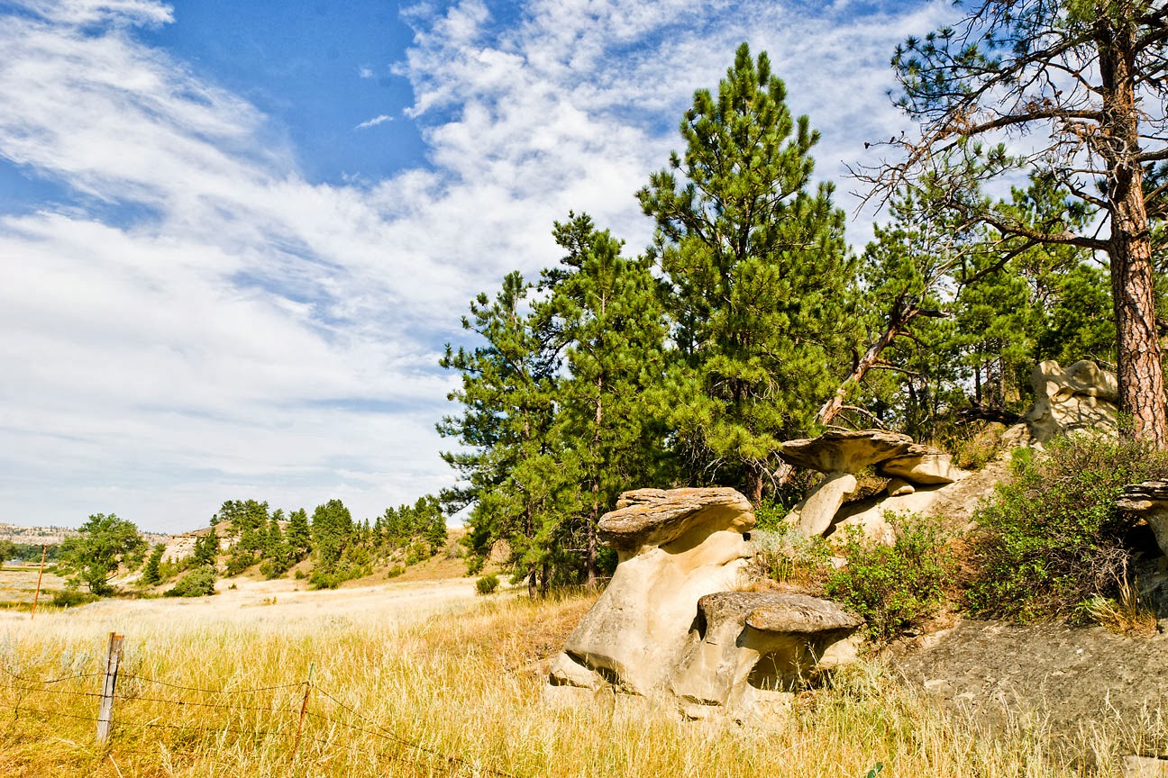
Treasure County Landscape
Southwest of Hysham


While Treasure County itself does not seem to have its own website (the Treasure County Health Department does, though), the Hysham Chamber of Commerce has a site that can be found at http://hysham.org/

Saturday, September 21, 2013

32. Stillwater County

Stillwater County was created on March 24, 1913 with land taken from its neighbors, Carbon (10) to the south, Sweet Grass (40) to the west and Yellowstone (3) to the east.  It is named for a very swift flowing stream, the Stillwater River, that flows in a northeasterly direction from its source high in the Absaroka-Beartooth Wilderness to its confluence with the Yellowstone near the town of Columbus, Stillwater County's Seat.  Jim Annin, writing in the Columbus News in 1916, retells a lovely legend about how such a torrent would be named Stillwater.  His story was printed in volume two of the collection of Stillwater County histories, They Gazed on the Beartooths.

Today, according to the 2013 US Census estimate, 9,318 people call Stillwater County home.  This is the highest population in the county's hundred year history.  The 1920 Census counted 7,630 people and this number dropped every decade (with the exception of a 2% increase shown by the 1960 Census) until 1980, when the population showed a significant (20.9%) increase over the previous count, and each Census enumeration since has continued to climb.  My best guess would be that the completion of Interstate 90 has allowed Stillwater County to grow as a bedroom community for its large neighbor to the east, Yellowstone County (3), Montana's most populous and busiest county.  In-county growth was also helped by the establishment of the Stillwater Mine near Nye in the late 1970s.

The county covers 1,805 square miles (of which 10 square miles are water).  The landscape is mostly rolling farm land that drops from the Beartooth Mountains in the south to the Yellowstone River Valley which divides the county in half as it flows toward the north-east across Montana.  North of the Yellowstone, the county is mostly dry ranchland.  Wikipedia lists 78 lakes and two reservoirs in the county, ranging in elevation from over 10,000 feet to just over 3,900 feet.  Park City, near the Yellowstone County line is probably the lowest town in the county, lying just one foot below 3,400 feet.

The Stillwater County Courthouse
Columbus, Montana


At the time of county formation, the local folk chose Columbus as their seat.  Today Columbus is the largest community in Stillwater County, with a 2012  estimated population of 1,942.  It is also about as central a location as can be found in the county, thus making it an appropriate site for local government.  The people of Stillwater County tried several times to get their own county established, first in 1907 when they proposed Roosevelt County to the state legislature.  Due to the opposition from Yellowstone and Carbon Counties primarily, that proposal failed.  As did a second attempt in 1909 and a third in 1911.  (Note:  Roosevelt County (17), eventually came into being, but in a completely different part of the state.)  But the times were changing, and a new law was introduced allowing the residents of an area to request county-status.  This was the turning point, and over the next ten years twenty-two counties were formed, including Stillwater.  Still, it is amusing to read some of the charges brought up against dividing the existing counties.  Many of these are recorded in They Gazed on the Beartooths in the section titled:  Stillwater County--A Commonwealth in the Embryo.

Occident Flour Elevator, Reed Point, Montana

On the western edge of Stillwater County lies the town of Reed Point.  The county line dividing Stillwater and Sweet Grass (40) counties is approximately two miles west of Reed Point.  This town of less than 200 people (185 in the 2000 Census) made a name for itself during Montana's Centennial Year, 1989.  As a response to the Montana Great Centennial Cattle Drive (see 23 Musselshell County), the people of Reed Point decided to host a fund raiser of their own, the Great Montana Sheep Drive.  Originally dreamt up as a spoof, but with the goal of raising funds for the town's library, the Sheep Drive succeeded beyond anyone's wildest imagining.  (I know, I was there.)  So many people showed up to watch the "running of the sheep," that the Montana Highway Patrol gave up and allowed people to park alongside Interstate 90.  There was simply no room in town to handle the cars.  There was hardly enough room on the town's streets for the 10,000 visitors who showed up.  This crazy joke has now been going on for twenty-five years, as each year Reed Point hosts one of Montana's largest Labor Day Weekend events.

Countryside south of Reed Point, showing the effects of the wildfires of 2004, 2006 and 2010


In southwestern Stillwater County lies the town of Nye.  Nye is the home of the Stillwater Mining Company, the only US producer of palladium and platinum.  Early day miners sought copper, nickel and chromium in the hills around Nye, but in the early 1970s, geologists working for the Johns-Manville Corporation discovered a band of palladium and platinum in what they named the J-M Reef.  Working together with Chevron, USA, Manville opened up the first underground mine in 1986, and in 1992 the two companies formed Stillwater Mining, with each parent company owning 50% of the new venture.   In addition to their mining operations at Nye and near Big Timber (Sweet Grass County, 40), Stillwater Mining operates a smelter at Columbus where they not only refine the ore mined upstream, but they recycle automotive catalytic converters.  It is primarily because of Stillwater Mining that 25.6% of the men in Stillwater County are involved in the mining industry, more than any other sector.  Agriculture, in contrast, comes in second with only 14.4%.

Stillwater County holds the distinction of being the home of the first white settlers of what was to become Yellowstone County then Stillwater County.  Three men built their homes and established businesses at Stillwater, just east of present-day Columbus.  One of these men, W.H. Norton, owned the General Store.  In 1894, officials of the Northern Pacific Railroad requested that the name "Stillwater" be changed to Columbus, and the Post Office agreed to the change.  In 1899, Norton built his home on 3rd Avenue.  With the creation of Stillwater County, Norton sold his house and land to the county, and his house became the Stillwater County Sheriff's Office, Residence, and County Jail.  In time the Stillwater County Courthouse was built right next door.

W.H. Norton House, Columbus, Montana
The Stillwater County Sheriff's Office and residence from 1913 to 1940.

Stillwater County's website is found at:  http://www.stillwater.mt.gov/
The town of Columbus has its site at: http://www.townofcolumbus.com/