Wednesday, December 7, 2011

21. Toole County


Toole County, named for Montana's first (and fourth) governor, Joseph K. Toole, was created in 1914 with land taken from Hill County (12) and Teton County (31). The Toole family has continued to be important in Montana business, politics and education, with one member currently serving on the Montana Public Service Commission.

Toole County lies east of the Continental Divide and its northern line forms the international boundary with Alberta, Canada. The county is traversed east to west by U.S. Highway 2, the Hi-Line, and the Burlington Northern Santa Fe Railroad which parallels US 2, and north to south by US Interstate 15, which has its northern terminus at the international port of entry known as Sweet Grass on the U.S. side and Coutts on the Canadian. Shelby, the Toole County seat, is a station on Amtrak's Empire Builder route.

Most of Toole County is relatively flat (by Montana standards)

Topographically, Toole County is far enough north and east of the Rockies to be relatively flat land, at least by Montana standards. The main exception is an isolated mountain range straddling the Toole/Liberty county line just south of the Canadian border known as the Sweet Grass Hills. These "hills" rise some 3,000 feet above the plain, and were considered sacred by the Blackfoot people who originally lived in this area. West Butte, at 6,983 feet (2,128 meters) and Gold Butte (6,512 feet) are both fully within Toole County most of which sits at 3,200-3,300 feet. The hills are easily visible from US 2, Interstate 15, and even the Crowsnest Highway in Alberta. The discovery of gold (hence Gold Butte) in 1885 brought miners to the area, and in 1888 the Blackfoot "sold" the hills and the area was opened to white settlement.

One of the few counties east of the Rockies to post an increase in population, Toole County recorded 5,324 residents in 2010, a 1.1% increase from the 2000 count of 5,267, although still down considerably from the 1960 high point of 7,904. Given the fact that most areas east of the Divide are losing population, I have to wonder if this recent increase is due to the opening of the Crossroads Correctional Center, one of the private prisons run by Corrections Corporation of America, a facility that first opened in 1999. While the inmate population would not be counted in the census, the growth of the prison brought new jobs and therefore new residents to Shelby, the Toole County seat. According to city-data.com, law enforcement is tied for second place after farming, accounting for 6% of the employed males in Toole County.


Shelby, Toole's County Seat, as is the case for so many Montana towns, got its name because of the railroad. Peter O. Shelby was president of the Montana Central Railroad, a north-south line built to connect the mines at Butte and the new city of Great Falls with the east-west Great Northern Railroad. The town has had a colorful history, being the only town in Montana to ever host a professional heavy-weight boxing match, in this case with champion Jack Dempsey going fifteen rounds against challenger Tommy Gibbons. Big Sky Fishing.com (yes, indeedy) has a wonderful write-up on the match, one that turned out to be a fiasco for the city of Shelby.

Today, Shelby is a small community of 3,500 residents, or two-thirds the population of the county. Other Toole County communities include the afore-mentioned port of entry at Sweet Grass, the town of Sunburst just south of Sweet Grass, Kevin (pronounced Kee-vin), Galata (really just a wide-spot in the road north of the Tiber Dam Reservoir), Oilmont (wonder where it got that name), Ethridge, and Dunkirk. Most of these "communities" are little more than what is left of someone's dream.

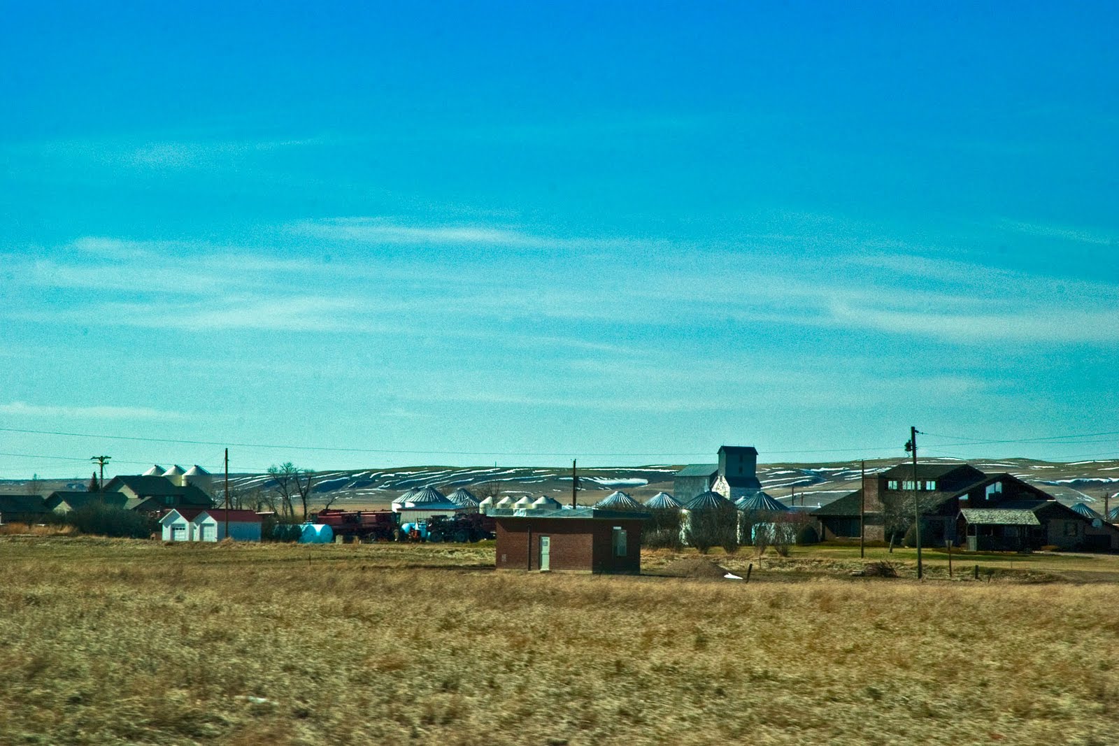
Small Town on the Prairie (Devon, Montana?)

Oil was discovered in 1922, and the oil fields between Shelby and the Canadian border continue to produce today. The formations are usually less than 2,000 feet deep, and thus cost-effective from a producer's viewpoint. Wind power is becoming increasingly important with two major wind farms currently operating or under construction in the county. While the economic power of energy cannot be denied, agriculture is still Toole County's principal mover, with twenty percent of the male population either farmers, farm managers or agricultural workers. The average sized farm covers 2,686 acres and the average value of agricultural products sold per farm is $84,977. Lest we think the Toole County farmers are making a killing at their enterprise, the average cost per farm is $96,695. Livestock and poultry (and their products) account for some 25% of the total, and 247,135 acres are planted in wheat. Sixty-five percent of all farms are family or individually owned, and the principal operator has an average age of 57. (All figures courtesy of city-data.com.)


Grain Elevators are usually the tallest structures on the prairie


Toole County's official website can be found at: http://www.toolecountymt.gov/
The city of Shelby has its website at: http://www.shelbymt.com/


Photo Information (All photos taken with a Nikon D80 DSLR and a Nikkor 16-85 mm wide angle/tele/zoom lens):

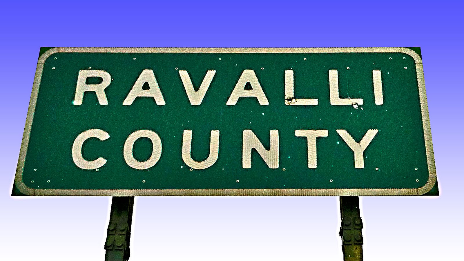
Toole County Sign: Taken 4/23/2011 along US Highway 2 at the Toole/Liberty County Line. Lens set at 85 mm. ISO 200, f /16.0, 1/90 second.

Railroad and Buttes (flat landscape): Taken 4/23/2011 from US Highway 2, Toole County, Montana. Lens set at 70 mm. ISO 200, f /16.0, 1/350 second.

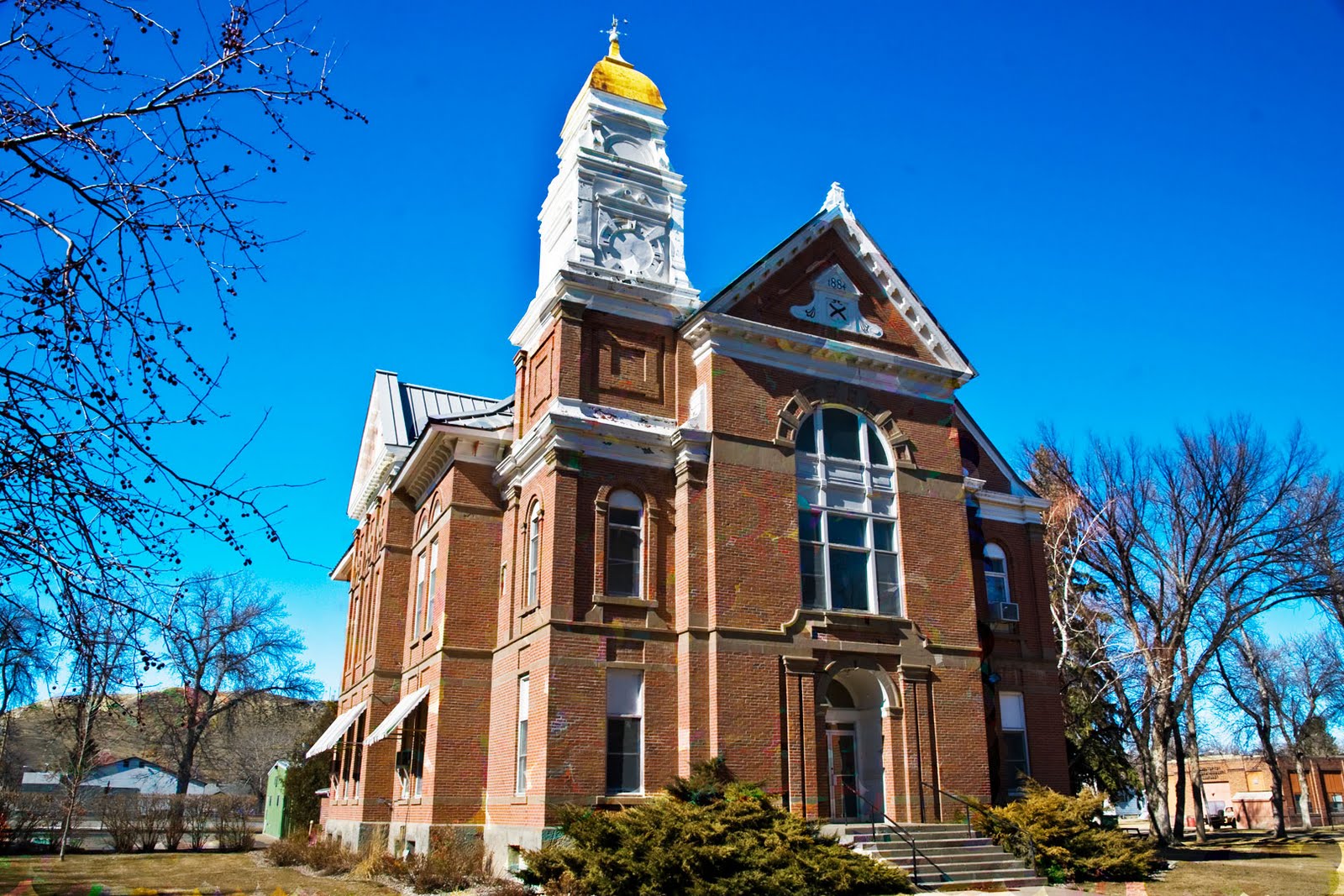
Toole County Courthouse: Taken 10/8/2009 in Shelby, Montana. Lens set at 28 mm. ISO 250, f /8.0, 1/250 second.

Small Town: Taken 4/23/2011 from US Highway 2, Toole, County, Montana. Lens set at 85 mm. ISO 200, f /16.0, 1/500 second.

Grain Elevator: Taken 4/23/2011 from US Highway 2, Toole County, Montana. Lens set at 85 mm. ISO 200, f /16.0, 1/250 second.


Thursday, October 6, 2011

20. Valley County


Created on February sixth, 1893, when the Montana legislature split Dawson County (16) in half, Valley County covered all of eastern Montana north of the Missouri River. It remained intact for twenty years until 1913 when the county was split to form Sheridan County (34) along the North Dakota border. In 1915, Phillips County (11) was created with land taken from western Valley County and eastern Blaine County (24). Valley County was reduced in size again in 1919 with the creation of Roosevelt County (17) and in 1920 when Daniels County (37) was created. Since 1920, Valley County has remained untouched, with a 2010 population of 7,329 and a total area of 5,062 square miles. This makes it just smaller than the state of Connecticut, but much, much larger than Delaware. The 2010 census count is down 4% from the 2000 count, the fifth consecutive population decrease since 1960 when the county's population was at its highest number, 17,080.

Glasgow, named for Scotland's largest city, began as one of James J. Hill's railroad towns in 1887. It's 2011 population was estimated to be 2,965. As the largest community in the area, Glasgow was chosen to be the seat of newly formed Valley County, and it has remained the seat ever since the county's formation.

Valley County Courthouse
The Valley County Courthouse, Glasgow, Montana

Glasgow and Valley County experienced their first growth spurt between 1900 and 1910 when the county's population grew over 300%. By the 1920 census, all the divisions of the county had been completed, and the population reflected a drop of 15%. The population continued to drop until the 1930s during which time the U.S. Army Corps of Engineers built the Fort Peck Dam across the Missouri River. Construction of the dam, which took seven years to complete, brought many new residents to the county, and the 1940 census showed a 35% increase. The dam remains the largest hydraulically filled dam in the United States, and is one of the largest earth fill dams in the world. The lake formed behind the dam is Montana's largest body of water, with a shoreline of over 1500 miles. Completely within the Charles M. Russell National Wildlife Refuge, the lake is a popular destination for outdoor enthusiasts of all persuasions. For those with an interest in historic preservation, eight of Valley County's sites on the National Register of Historic Places are at Fort Peck, including the theatre.

The Theatre at Fort Peck

As a result of U.S. entry into World War II, the country activated the Glasgow Army Airfield on November 10, 1942. It was originally a satellite of the larger airfield in Great Falls, Montana (now Malmstrom Air Force Base). Deactivated at the end of the war, the base came back into prominence during the Vietnam war, and with it Valley County's population surged again, reaching an all-time high in 1960. The subsequent history of the Glasgow Airbase reads like a business soap opera, with exciting high hopes and devastating betrayals. Today, driving along Montana Highway 24 north of Glasgow, you come to a sign for St Marie. To the east you can see what looks to be a rather large city, but should you turn off the highway, you enter a ghost town, albeit a ghost town with 1960s architecture. Today 183 people live in a "city" designed to hold 10,000.

In addition to Glasgow, Fort Peck, and St Marie, other communities in Valley County include Frazer, Hinsdale, Nashua and Opheim.


The Hinsdale United Methodist Church

The early days of Glasgow and Valley County were typical of the Wild West in general, and Montana in particular. The local newspaper had two reports of the death of one resident on July 28, 1894. The two articles follow:

p.3 - Made His Last Fight - Allison Tisdale Killed in a Gun Fight by George Dunnell. Glasgow's wonted quietness was rudely disturbed Tuesday evening at 11 o'clock by five pistol shots fired in rapid succession. The shooting was the result of a quarrel over horses between A.A. Tisdale, alias Al. Allison, and Geo. Dunnell. (Full story).. J. DeRobbins took the gun from his hand, and Dunnell handed his revolver to the under sheriff and surrendered. Tisdale only lived a few seconds after he fell. He never said a word after the shooting commenced. The body was laid out in the office of the Waldo house and an inquest held. The verdict of the jury was that he met death from a pistol ball fired by George Dunnell. The preliminary hearing of Dunnell occured in the court house Wednsday afternoon. The evidence showed that the murdered man was a hard case and regarded life lightly. The defendant was discharged, as there was no evidence against him. It was a plain case of self defense and justifiable homicide.
P.3 - A.A Tisdale, who was killed here Tuesday evening, was born in Williamson county, Texas. His father was a wealthy man and the owner of the old Oregon farm. His family were religious people, the father being one of the pillars of the M.E. church in Georgetown, the county seat of Williamson county. He was also a high mason. Al left home when young and had a bunch of cattle in New Mexico. He got into trouble there, and left all his property and went to Johnson county, Wyoming. There he was the first man black-balled for mavericking and was the main instigator of the war between the cowboys and stockmen that darkened the annals of the history of Wyoming. He had the respect and sympathy of the people of the county a long time, and was a partner of Jack Flagg, editor of the People's Voice, and at present clerk and recorder of Johnson county. During the war between there two factions John Tisdale, brother of Al, was murdered by the stockmen. Then Al began drinking and carousing and finally lost the respect of everyone. He came from Wyoming to Montana, and has been in this section of the country for about three years....

Today visitors to Glasgow and Valley County will find a modern community, with motels, restaurants and other amenities to serve their needs, and a friendly population willing to answer questions and direct you to the various points of interest in the area.

Montana Highway 24, north of Glasgow, Montana

Valley County's web site can be found at:http://valleycountymt.net/
The City of Glasgow has its own site at: http://www.glasgowmt.net/


Photo Information (all photos taken with a Nikon D80 DSLR and a Nikkor 16-85 mm wide angle/tele/zoom lens):

Valley County Sign. Taken 8/27/2011 on the Daniels/Valley County Line, Montana Highway 5 east of Opheim, Montana. Lens set at 68 mm, ISO 100, f /11.0, 1/45 second.

Valley County Court House. Taken 10/7/2009 in Glasgow, Montana. Lens set at 35 mm. ISO 250, f /22.0, 1/45 second.

Fort Peck Theatre. Taken 8/28/2011 in Fort Peck, Montana. Lens set at 25 mm. ISO 100, f /11.0, 1/90 second.

Hinsdale UMC. Taken 8/28/2011 in Hinsdale, Montana. Lens set at 25 mm. ISO 100, f /11.0, 1/90 second.

Evening Farmland. Taken 8/27/2011 along Montana Highway 24. Nikon D80 DSLR, Nikkor 16-85 mm lens set at 16 mm. ISO 100, f /13.0, 1/20 second.

Saturday, September 10, 2011

19. Chouteau County


NOTE: Clicking on any picture will open a new window with a full-screen view of the picture. Also all links open in a new window.

One of the original nine territorial counties created on February 2, 1865, Chouteau County covered all of north central Montana. Eventually Meagher (Number 47), Fergus (8), Cascade (2), Teton (31), Broadwater (43), Hill (12), Blaine (24), Toole (21), Phillips (11), Wheatland (44), Glacier (38), Pondera (26), Liberty (48), Judith Basin (36), and Petroleum (55) counties would all be formed (at least in part) from land taken from the original Chouteau County.

Pierre (1789 - 1865) and his brother Auguste (1786-1838) Chouteau grew up in an important American fur trading family. Their father (Pierre, senior) and uncle (Auguste) were born into a French family in New Orleans, New France, and uncle Auguste later founded St. Louis, Missouri. The older generation, still French nationals, proved very helpful to Lewis and Clark, The younger generation were involved in John Jacob Astor's American Fur Company and founded several mercantile forts including Fort Pierre (across the river from Pierre, South Dakota) and Fort Benton (now the county seat of Chouteau County). Choteau, Montana (Teton County's seat) bears Pierre's name and Chouteau, Oklahoma was named for Auguste. The Chouteau brothers named Fort Benton after their friend, influential Missouri Senator Thomas Hart Benton.


The Chouteau County Court House
Fort Benton, Montana

The Chouteau brothers established Fort Benton in 1847, making it one of the oldest communities in the American West. It was the last trading post on the Missouri River, and as such the town around the fort grew into a major shipping center. Steamboats based as far away as New Orleans docked at Fort Benton, and in 1860, the U.S. Army began construction of the 642 mile Mullan Road, designed to connect the Missouri River at Fort Benton to the Columbia River (well, actually the Snake River) at Fort Walla Walla (now in Washington State). The city's website claims that the town was once the "world's innermost port." Built in 1884, the county's court house is the second oldest such building still in use in Montana. Fort Benton is also home to the first bridge built in Montana spanning the Missouri River, the Grand Union Hotel (once deemed the "finest accommodations between Minneapolis and Seattle"), the "Bloodiest Block in the West" where twelve of the thirteen establishments were saloons, dance halls, or brothels, the Museum of the Upper Missouri, and the Upper Missouri River Breaks National Monument Interpretive Center. It is also home to Montana's oldest Episcopal Church, St. Paul's, in continuous service since 1881. In short, there's plenty of places to visit in historic Fort Benton.

St. Paul's Episcopal Church
The Oldest Episcopal Church in Montana

Chouteau County today covers 3,997 square miles, of which 24 are water. The 2010 U.S. Census counted 5,813 county residents, down from 5,970 in 2000. The highest population count for Choteau County in its present formation was in 1930, when the Census counted 8,635 residents. The county is Montana's number one winter wheat producer, and as across all of Montana, agriculture forms the principal industry. Forty-seven percent of the industry in Chouteau County is agriculture, dwarfing the second largest industry, construction, with eight percent. Forty-four percent of the men and eight percent of the women are employed as farmers, farm managers or agricultural workers. The average size farm is 2,924 acres, and 63.15% of all farms in the county are owned by individuals or families.

At the very northern edge of the county, you'll enter the Rocky Boy Indian Reservation (most of which is in neighboring Hill County.) Rocky Boy is home to the Chippewa-Cree tribe, made up of Chippewa and Métis who moved south from Canada and Cree who moved west from North Dakota. Rocky Boy, the smallest of Montana's seven reservations, is home to Stone Child College, one of the tribally run junior colleges in Montana.

The Missouri River, which divides the county in half and was responsible for the county's historical importance, is the county's most prominent topographical feature, along with its tributaries the Teton and Marias Rivers. US Highway 87 is the only federal highway in the county. Fort Benton sits 40 miles north of Great Falls and 75 miles south of Havre on the east side of US 87, a two-lane road. The highway passes miles and miles of wheat fields, and bypasses the towns of Floweree, Carter, Loma, Big Sandy and Box Elder as you cross the county. For my money, the best way to cross Chouteau County is the same way Lewis and Clark, the Chouteau brothers, and thousands more did it--on the Missouri River.

The Old Fort Benton Bridge
Fort Benton, Montana

Driving north from Fort Benton, about fifteen miles past Loma, you will see a sign on the right pointing to Virgelle. Turn off 87 and take the dirt road approximately seven miles to the Virgelle Mercantile. You can't miss it. It's the only building in Virgelle. The Virgelle Merc is a combination bed & breakfast and antique store, and is the home of Don Sorensen and the Missouri River Canoe Company. Don will put you up overnight, fully outfit your trip, and send you on the adventure of a lifetime. I know, I did it four years in a row back in the mid 1990s, and I'd gladly do it again and again. Once on the river, you'll see the country virtually unchanged from the way Lewis and Clark saw it in 1804. There are no bridges on a fifty-mile stretch of the river, and once you put in at Virgelle Landing, you can spend the next four days crossing one of the most amazing landscapes in the western United States. Be forewarned, Montana weather is highly unpredictable, so be prepared for everything from blazing sun to pouring rain. The river is slow, and there are stretches where you will have to paddle with all you've got in you, just to move on downstream against the prevailing head winds. But oh is it worth it. And by all means, take along the relevant portion of Lewis & Clark's journals. As you camp each night, you can read about the section you've just passed and feel as if you've traveled back two hundred years in time. (I'll take my canoe over their boats, though, and my tent, sleeping bag and air mattress over their gear any day.)

The Missouri Breaks
Chouteau County, Montana

Photo Information:

Chouteau County Sign: Taken 4/23/2011 on the Chouteau/Hill County Line, US Highway 87. ISO 200, f /16.0, 1/125 second. Nikkor 16-85 mm lens set at 32 mm.

Chouteau County Court House: Taken 3/14/2010 in Fort Benton, Montana. ISO 125, f /11.0, 1/60 second. Nikkor 16-85 mm lens set at 16 mm.

St Paul's Episcopal Church: Taken 3/14/2010 in Fort Benton, Montana. ISO 125, f /11.0, 1/20 second. Nikkor 16-85 mm lens set at 16 mm.

Fort Benton Bridge: Taken 3/14/2010 in Fort Benton, Montana. ISO 125, f /11.0, 1/180 second. Nikkor 16-85 mm lens set at 22 mm.

Missouri Breaks: Scanned from a photograph taken in August, 1995, looking down at the Missouri River. No data available.

Monday, September 5, 2011

18. Beaverhead County

One of the original nine counties formed when Montana became a territory, Beaverhead County is the only one not to lose much of its original size due to the formation of new counties. Aside from a minor county line adjustment with neighboring Madison County (number 25), Beaverhead County today covers the same area it did in 1865. Today it is the largest county in area in the State of Montana, covering 5,572 square miles of which 30 are water. With a 2010 population of 9,246 (up .5% from the 2000 count of 9,198), the county has a population density of 1.7 people per square mile. Located in the southwestern corner of the state, Beaverhead County is bounded by the Continental Divide which separates it from the state of Idaho on the south and west, and from Ravalli County (number 13) on the northwest. While there are numerous mountain lakes throughout the county, the largest single body of water is the Clark Canyon Reservoir, formed in 1964 when the U.S. Bureau of Reclamation built the Clark Canyon Dam on the Beaverhead River south of Dillon, the County Seat.

The Beaverhead County Courthouse
Dillon, Montana

Founded in 1857, Dillon is one of the oldest cities in Montana, and with a 2010 population of 4,134, the largest city in Beaverhead County. Named for the president of the Union Pacific Railroad, Sidney V. Dillon, the town got its start as a shipping point for goods coming up from Utah for the mining camps in Montana. Agriculture and livestock production soon established its pre-eminence, and Dillon for a time shipped more wool out of Montana than any other Montana location. Cattle, too, have played an important role in the county's history, and the Big Hole Valley in the western part of the county has been called the "Land of 10,000 Haystacks."

Dillon is home to the University of Montana-Western(formerly known as Western Montana College). Founded in 1893 as the Montana State Normal School, Western today maintains its tradition of excellence in teacher education while offering a full course of study leading to Associate and Bachelors Degrees in Biology, Business, Education, English, Environmental Studies, Equine Studies, Fine Arts, Mathematics and the Social Sciences.

Land of 10,000 Haystacks
The Big Hole Valley

Beaverhead County offers a wealth of recreational opportunities. Fisherman consider the Big Hole and Beaverhead Rivers to be blue-ribbon trout streams. Hunters flock to the Big Hole Valley for big game and birds. RATPOD (Ride Around the Pioneers in One Day) attracts over 600 bike riders each year for a 130 mile ride through breath-taking mountain vistas and elevations ranging from 5100 feet at Dillon to over 8000 feet on the Pioneer Scenic Byway. Along the way, riders pass by Elkhorn Hot Springs and Crystal Park, two other favorite recreational sites in Beaverhead County. In the winter, snowmobilers take over the mountain roads, and skiers can find miles of cross-country trails and downhill skiing available at Maverick Mountain.

Upper Twin Lake
Bitterroot Mountains

History buffs have plenty sites to visit in Beaverhead County. Those first great western US travelers, Lewis & Clark, came through the area. Their Shoshone guide Sacagawea showed them a rock formation the Shoshone thought looked like a beaver's head. The county is named for that rock formation. The Corps of Discovery (Lewis & Clark) camped for several days at Camp Fortunate, now unfortunately submerged under the waters of the Clark Canyon Reservoir. When Sidney Edgerton convinced the U.S. Congress to create Montana Territory in 1864, and arrived to serve as the first territorial governor, his capital city was Bannack, now a Montana State Park and well preserved ghost town. On a more somber note, the Big Hole National Battlefield commemorates the August 9, 1877 battle between the U.S. Cavalry and a group of Nez Percé indians led by Chief Joseph. The cavalry attacked before dawn, killing over 90 sleeping indians and losing over thirty of their own men. I cannot visit the site without chills running down my spine.

The Masonic Lodge
Bannack Montana

Today, agriculture (including forestry, fishing and hunting) accounts for twenty-five percent of the county's industrial base, roughly two and a half times the state average. Construction follows at twelve percent and educational services at ten. For men, eleven percent are employed as farmers with an additional nine percent employed as agricultural workers. No other industry comes close. The average size of a Beaverhead County farm is 3,038 acres with an average annual sales of $150,274 and average expenses of $129,006. The average age of the principal farmer is 55, and 66% of the farms are family or individually owned.

Median household income is $37,116, or $5,000 below the Montana state median, and sixty-three percent of workers earn a salary or wage. Twenty-five percent work for the government, and eleven percent are self-employed. All data comes from the city-data.com website.

Photo Information:

Beaverhead County Sign: Taken 2/14/2010 at the Beaverhead/Madison County Line on Montana Highway 41. Focal length: 52 mm. ISO 125, f /19.0, 1/45 second.

Beaverhead County Courthouse: Taken 2/14/2010 in Dillon, Montana. Focal length: 18 mm. ISO 125, f /19.0, 1/60 second.

Land of 10,000 Haystacks: Taken 9/7/2008 near Jackson, Montana. Focal length: 48 mm. ISO 200, f /9.5, 1/350 second.

Upper Twin Lake: Taken 9/7/2008 in the Bitterroot Mountains. Focal length: 56 mm. ISO 200, f /9.5, 1/125 second.

Masonic Lodge: Taken 6/6/2009 in Bannack, Montana. Focal length: 45 mm. ISO 200, f /5.6, 1/500 second.

Saturday, September 3, 2011

17. Roosevelt County

Roosevelt County SignPresident Theodore Roosevelt had spent more time in the West than any of his predecessors. After he died on January 6, 1919, the State of Montana honored him by dividing Sheridan County (number 34) along an east-west axis, and naming the southern section Roosevelt County. This happened on February 18, 1919. Note that Montana created seven counties in February and March of 1919, and another four in 1920, but the location of Roosevelt County makes it particularly apt for honoring its namesake, being the only one of the eleven new counties to border North Dakota where Roosevelt had his ranch. The county is rectangular in shape, having a natural southern border on the Missouri River and an arbitrary northern border at approximately 48'34" north latitude for most of its extent, stair-stepping down to 48'23" at its eastern edge. The 2010 US Census counted 10,425 residents in the county, down 1.8% from the 2000 count of 10,620.

The largest city and county seat is Wolf Point, located in the extreme southwestern corner of the county, on the Missouri River floodplain. The courthouse was built through the depression-era Works Progress Administration (WPA), as were several other local buildings. Wolf Point, incorporated in 1915, had a 2010 population of 2,621, down 2% from the 2000 count of 2663. and down considerably from its high in 1960 of 3,585. Wolf Point is home to the oldest rodeo in Montana, the Wild Horse Stampede, held annually since 1921 on the second weekend in July. Wolf Point is also home of the Montana Cowboy Hall of Fame and Western Heritage Center. Fort Peck Community College has a branch campus in the city as well.

The Roosevelt County Courthouse
Wolf Point, Montana

The Fort Peck Indian Reservation covers most of Roosevelt County. Established in 1871, the Reservation is home to the Assiniboine and Sioux people. The current tribal agency town is Poplar, Roosevelt County's only other incorporated city. The Reservation extends some 100 miles in length and 40 miles in width, crossing into neighboring Valley (number 20), Sheridan (34) and Daniels (37) counties. The Reservation was opened to non-Indian settlement in 1913, and today, of the over 2 million acres included in the Reservation, Indian-owned land amounts to less than half. As is the case so often with European/Native interactions, the history of the Sioux and Assiniboine people on the Fort Peck Reservation is filled with tragedy. Ill-supplied, many native people lived in poverty and hundreds starved to death in the early days of the Reservation. The Presbyterian Church, through their Board of Foreign Missions (!) was quite active in the area, and built churches and schools at Wolf Point, Poplar, Brockton (Makaicu), Ash Point (Hohay), and Chelsea (Minisdah). The Minisdah church was organized on December 15, 1904, and today stands abandonned, with a large, unkempt cemetery hidden in the weeds behind the church.

Minisdah Presbyterian ChurchThe Minisdah Presbyterian Church
Organized 1904
Chelsea, Montana


Roosevelt County and the Fort Peck Reservation are also home to the Fort Peck Community College with its main campus in Poplar and a branch campus in Wolf Point. One of seven tribal colleges in Montana, Fort Peck Community College awarded its first degree in 1987. With an average enrollment of 435 students, over 75% are Native American students resident on the Reservation. The college offers Associate of Arts, Associate of Science, Associate of Applied Science degrees, and has various one year certificate programs.

As the Reservation covers over 74% of the land area of Roosevelt County, it should not come as a surprise that the county's demographics are heavily skewed by the Native population. Forty-seven point four percent of the population claim to be solely of Native blood, while an additional 14.7% claim to be of two or more races. Only 36.4% claim to be "white." Median household income is considerably below the state's average, and the number of individuals living below the poverty level is more than twice the rate for the whole state. Employment figures show that 46% of workers work in private industry and 38% work for the government. Fifteen percent are self employed. Unemployment, at 8.6%, is only slightly higher than the state's rate. The most common industry is agriculture which makes up 21% of the county's total, and the most common male occupation is farming (16% with an additional 4% employed as agricultural workers and supervisors). Women are most commonly employed in the education and health care fields.

Cattle cooling off in the summer heat
Froid, Montana

The average size of farm in Roosevelt County is 2,111 acres, 81.11% of which are family owned. The average value of products sold per farm was $74,366 in 2009, while the average cost of producing those products was $63,699, and the average age for the principal farm operators was 58. Livestock accounted for 22.69% of agricultural value, and wheat was the principal crop, with 319,614 acres planted. All figures in the previous two paragraphs come from the city-data.com website.

If you drive fifteen miles over dirt roads southeast from Bainville, you arrive at the North Dakota State Line and Fort Union. While Fort Union is technically speaking in North Dakota, it is considered such an important part of Montana history that it routinely shows up in various lists of things to see and do while visiting Montana. Operating between 1828 and 1867, Fort Union was the longest lasting trading post in the American West. And make no mistake, this was not a government or military post but a business run by the American Fur Company. Despite the difficult road (it's easier coming in from the North Dakota side), Fort Union is well worth a visit as it depicts the way life was lived on the northern prairies in the early 1800s. The Fort has been reconstructed on the north bank of the Missouri, and there are many living history enactments throughout the summer months.


Fort Union tipisIndian Encampment Display
Fort Union

Photo Information:

Roosevelt County Sign: Taken 8/26/2011 at the Wolf Point Bridge on the Roosevelt/McCone County Line. Focal length: 38 mm. ISO 200, f /11.0, 1/250 second.

Roosevelt County Courthouse: Taken 10/7/2009 in Wolf Point, Montana. Focal length: 18 mm. ISO 250, f /22.0, 1/45 second.

Minisdah Presbyterian Church: Taken 8/26/2011 at Chelsea, Montana. Focal length: 25 mm. ISO 200, f /11.0, 1/250 second.

Happy Hour at the Watering Hole: Taken 8/27/2011 near Froid, Montana. Focal length: 80 mm. ISO 125, f /11.0, 1/45 second.

Fort Union Tipis: Taken 8/26/2011 at Fort Union, Montana/North Dakota. Focal length: 58 mm. ISO 200, f /11.0, 1/350 second.


Thursday, September 1, 2011

16. Dawson County


While not one of the original territorial counties, Dawson County followed quickly in their steps. Taking the northern section of the original Big Horn County (see Custer County, number 14), Montana Territory created Dawson County on January 15, 1869, five years after the territory itself came into existence. Dawson County gets its name from Major Andrew Dawson, manager of the Fort Benton Trading Post from 1856 to 1864. In its original form, Dawson County took in all of Montana east of the 109th longitude and north of the 47th parallel. Today, the county covers 2,383 square miles, of which 10 square miles is water. From a population of 2,443 in 1900, the county quickly grew to 12,725 in 1910, a figure it has never again achieved. Of course, in 1910, it still covered almost all of northeastern Montana, Valley County (number 20) being the only portion separated from Dawson before 1910. In the next decade, Sheridan (34), Richland (27), Wibaux (52), Prairie (45), and Garfield (50) Counties would all be formed from parts of Dawson, and the 1920 Census counted 9,239 people in the greatly reduced in size Dawson County. By 1930, all fifty-six of Montana's counties had been created, and Dawson County had just under 10,000 residents. A new population high was recorded in the 1960 census, 12,314, but since the census has recorded a fairly steady decline. The 2010 census showed a population of 8,966, or 3.8 people per square mile.

The Dawson County Courthouse
207 W. Bell Street
Glendive Montana 59330

Glendive is both the largest (and only) city in the county and its seat. With a 2010 population of 4,935, over half the county's people live in its seat. The town got its name from a weathy Irish sportsman who in 1855 named his favorite hunting area using the Irish Gaelic words for Black Valley (Gleann dubh, or glen doove). The Nielsen organization has designated 210 television markets in the United States. Glendive has the smallest, number 210. Its one television station, KXGN, had a CBS affiliation and until 2009 also offered some prime-time NBC programming--the last station in the country to offer programs from more than one network.

Glendive also served as a rail hub for the Northern Pacific railway, and a handsome station still stands in the downtown area. In 1920, some 500 men worked for the railroad in town. Today, rail transportation accounts for 13% of the county's wealth, second only to agriculture, but it employs only four percent of the male population. Farmers and farm managers make up 13% of male workers, while electrical equipment mechanics and other installation, maintenance, and repair occupations account for 8% of male employment. Not surprisingly, women's occupations are primarily in health care, and secondarily secretarial, education, cleaning and maintenance and record keeping. Unemployment, as of April 2010, was 4.2%, half the state-wide rate. Sixty-seven percent of wage or salary earners are employed in the private sector, and only 20% have government jobs. Twelve percent are self-employed. These figures come from the city-data.com website, which has a wealth of information.

Makoshika State Park--Montana's largest

Covering 11,400 acres, Makoshika (ma-KO-shi-ka) State Park is the largest in Montana. It sits on the eastern edge of the city of Glendive, which allows that city's residents to claim that they are "Good People surrounded by Badlands." (Makoshika means "land of bad spirits," or badlands, in the Lakota language.) In addition to the Visitor's Center and Museum, the park also offers an amphitheater, a rifle range, archery range, group use shelter, campgrounds and even a disk golf course--all open to the public. The park has four miles of paved roads, approximately twelve miles of unpaved roads, and three hiking trails. Off-trail hiking is permitted in the park as well.

Dawson County Rangeland
Looking north from Interstate 94

Agriculture has always been important in this region, and even today cattle ranches still cover large tracts of land. Barley, oats, corn (maize) and wheat all grow profusely in the rich soil of the county's rolling hills. If you drive the back roads, you'll pass mile upon mile of rangeland covered with cattle grazing, or seemingly endless acres of wheat fields. Again quoting from the city-data.com website, the average size farm in Dawson County covers 2,703 acres, or 4.22 square miles, and on average, each farm brings in $69,247 annually at an average expense of $62,382. Not a lot of profit there. Over 75% of the farms are operated by an individual or family, and the average age of the principal farm operator is 55. If that doesn't worry you, it should. Only 6.69% of all farmland in the county is irrigated, with 1331 harvested acres planted in corn and 164,040 in wheat. The value of livestock, poultry and their products accounts for 46.17% of total agricultural market value.

Glendive is also home to one of Montana's two-year colleges, Dawson Community College, which offers Associate of Applied Science degrees in Agribusiness Technology, Agricultural Mechanics, Business Management, Criminal Justice, Early Childhood Education, Engineering Technology, Gas and Diesel Technology, and even Music Technology, by which they mean training toward careers in the following fields, among others: "sound engineer, recording engineer, audio engineer, sound/video editor, multimedia publisher, radio program director, disc jockey, engineer mixer." Dawson Community College offers Associate of Arts degrees in a variety of fields, on-going Adult Education, and on-line learning possibilities, as well as providing educational outreach opportunities across eastern Montana.

If, like me, you enjoy a good Sunday drive, Dawson County offers plenty of opportunities to get out and explore. Aside from Makoshika State Park's paved and unpaved roads, you can drive Interstate 94 east to Wibaux County (52), or southwest to Prairie County (45), Montana 16 north along the Yellowstone River to Richland County (27), or Montana 200S northwest to McCone County (41). Along the way to Circle in McCone County, you'll pass through Lindsay, an up and coming agricultural community in 1920, now reduced to a pair of elevators and a few buildings. You also have a plethora of choices should you find the dirt back roads intriguing.

On what can only be described as a bit of Montana trivia, I have now photographed road signs indicating county boundaries for each of Montana's fifty-six counties. All use only upper case letters with one exception--Dawson County, as seen above.

All that's left of a once-thriving community
Lindsay, Montana

Photo Information:

All photos were taken using a Nikon D80 DSLR, a Nikkor 16-85 wide angle/tele/zoom lens, and were shot in RAW format and processed using Photoshop CS4.

Dawson County Sign: Taken 8/26/2011 at the Dawson/Wibaux County Line on US Interstate 94, west bound. Focal length: 62 mm. ISO 200, f /11.0, 1/500 second.

Dawson County Courthouse: Taken 10/7/2009 in Glendive, Montana. Focal length: 16 mm. ISO 250, f /22.0, 1/125 second.

Dawson County Rangeland: Taken 8/26/2011 on US Interstate 94, west bound. Focal length: 85 mm. ISO 200, f /11.0, 1/250 second.

Makoshika State Park: Taken 8/26/2011 in Glendive, Montana. Focal length: 85 mm. ISO 200, f /11.0, 1/350 second.

Lindsay Elevators: Taken 8/26/2011 in Lindsay, Montana. Focal length: 80 mm. ISO 200, f /11.0, 1/250 second.

Tuesday, May 17, 2011

15. Lake County


NOTE: Clicking on any picture will open a new window with a full-screen view of the picture. Also all links open in a new window.

On August 11, 1923, the State of Montana formed Lake County by taking the southern part of Flathead County (number 7) and the northern portion of Missoula County (number 4). Named for its primary topographical feature, Flathead Lake, it was the next to last county created in Montana. Only Petroleum County (number 55) is younger. The county covers some 1,654 square miles, of which 160 square miles are water (mostly Flathead Lake). The Flathead Indian Reservation, otherwise known as the Confederated Salish and Kootenai Tribes of the Flathead Nation, makes up over two-thirds of the land area of the county. The Reservation plays such an important role in the county, that it is virtually impossible to talk about one without the other.

Lewis and Clark met the Salish in the Bitterroot Valley (Ravalli County, number 13) as they traveled across western Montana. They named the tribe "Flathead," based on a misunderstanding. Certain tribes practiced head flattening, but the Salish found that custom barbaric, according to some accounts. Lewis and Clark never actually set foot on land that would become Lake County. Historically, neither the Salish nor the Pend d'Oreille (Kalispel) indians lived in Lake County either. One band of Kootenai (the Ksanka) did live on the shores of Flathead Lake, and the US government forcibly moved the other tribes off their ancestral homelands and onto the reservation.

The Lake County Court House
Taken 12/11/2009 in Polson, Montana

In 1845, Frank McArthur of the Hudson Bay Company established Fort Connah as a fur-trading post. This was the first European settlement in what is now Lake County. In 1854, the Jesuits arrived and built St. Ignatius Mission. The Hellgate Treaty of 1855 established the Flathead Reservation, and Fort Connah closed in 1871. The first bison were introduced into the area in the 1870s, and the US established the National Bison Range in 1908.

The Mission Mountains
Taken 6/3/2010 in Ronan, Montana

Aside from Flathead Lake, the most conspicuous topographical feature in Lake County is the Mission Mountain Range, extending from south to north on the eastern side of the Mission Valley which forms the central part of the county. The western side of the range includes a Tribal Wilderness area, and you will need to obtain a tribal recreation permit to hike the numerous trails in the area. The Mission Mountain Wilderness covers much of the eastern slope of the range.

The US government opened the Flathead Reservation to white settlement in 1910, and the Lake County population has increased steadily since its creation in 1923. The 1930 U.S. Census counted 9,541 people living within the county. The 2010 Census showed a population of 28,746, an increase of 8.4% over the 2000 Census count. This makes Lake County the ninth largest in Montana by population. Broken down by racial lines, "white persons" constituted 69.4% of the total, while "American Indian and Alaska Native persons" made up 22%. 7.3% report belonging to two or more races. The largest growth spurts occurred during the 1970s and the 1990s when the county grew 31.9% and 26.0% respectively. Of the twenty cities, towns and "census designated places" in Lake County, whites outnumber native people in all but a handful of communities.


Northeastern Lake County
Taken 5/22/2010, north of Swan Lake, Montana

US Highway 93 bisects the county, running south to north from Missoula to Kalispell. It is one of, if not the most heavily traveled highways in Montana. Should you choose to drive this route, and you really should, here are my suggestions for places to visit along the way. 93 enters Lake County just south of the town of Arlee. Just after passing the Lake County sign, a road takes off to the right connecting with the Jocko Pass road across the Mission Mountains. If you're awfully brave, and have a heavy duty vehicle, you may want to take this side trip as the road is the only road that actually crosses the mountains, having an eastern terminus at Seeley Lake. Note that this drive is not for the faint-of-heart. Continuing on 93, stop at Huckleberry's in Arlee if you like licorice. They sell some fifty or more varieties of the candy from all over the world. North of Arlee, you will cross the Jocko River and shortly thereafter you can take a right turn on White Coyote Road to visit the Garden of 1000 Buddhas. Back on 93, you drive through the Jocko River Canyon, reaching the community of Ravalli a few miles further north. In Ravalli, you have the choice of turning west on Montana Highway 200 which will quickly take you into Sanders County (number 35), or staying on 93 and climbing the steep hill that separates Ravalli from St. Ignatius. Either way, you will be skirting the National Bison Range which you really should visit. So why not stop at the Bison Inn in Ravalli and refresh yourself with one of the best Indian Tacos available in Montana while you decide. If you're not that hungry, have a huckleberry shake. You'll love it. Should you stay on 93, as you reach the crest of the hill, note how the Missions just start appearing in an ever increasing number of peaks. Most of the year, they will be covered in snow and you'll understand why the native people called Montana "the land of shining mountains." In St. Ignatius, visit Doug Allard's Trading Post on the west side of the highway and St. Ignatius Mission on the east side. The former has an attached museum, and the trading post itself has a wealth of native-crafted items from all over the US. The church, built in 1891, is filled with art that will astound you, regardless of your religious beliefs.

Between St. Ignatius and Ronan, you'll pass through the Ninepipe Wildlife Refuge, a good place to count birds, turtles, and other wildlife. Stop at Cowboy Cappuccino in Ronan, a fun place to restore your caffeine levels, and in Pablo visit the Tribal Headquarters, Salish-Kootenai College, and the People's Center, Sqelixw Aqlsmaknik, to get a deeper understanding of the native life of this area.

Finally, as you crest the hill just south of Polson, Flathead Lake will come into view. The largest freshwater lake west of the Great Lakes, and the largest alpine lake in the US, Flathead Lake stretches 27.3 miles from south to north, and is up to 15.5 miles wide. It is a favorite recreation site for all of western Montana. At Polson, you'll have to decide whether to take the west shore or the east (93 follows the west), but rest assured that on either side, the lake will offer you an endless number of breathtaking views.

Flathead Lake from the west side
Taken 6/19/2010 north of Dayton, Montana

Photo Information:

Unless otherwise noted, all photos were taken using a Nikon D80 DSLR (Digital Single Lens Reflex camera) and a Nikkor 16-85 mm wide angle/tele/zoom lens. All photos are finished using Photoshop CS4.

Lake County Sign: Taken 5/22/2010. Focal length was 85 mm, ISO 250, f /9.5, 1/250 second.

Lake County Courthouse: Taken 12/11/2009 in Polson, Montana. Focal length was 40 mm, ISO 250, f /8.0, 1/750 second.

The Mission Mountains: Taken 6/3/2010 in Ronan, Montana. Focal length was 85 mm, ISO 125, f /8.0, 1/750 second.

Northeastern Lake County: Taken 5/22/2010 near Swan Lake, Montana. Focal length was 19 mm. ISO 250, f /16.0, 1/250 second.

Saturday Morning on the Lake: Taken 6/19/2010 near Dayton, Montana. Focal length was 24 mm, ISO 125, f /5.6, 1/350 second.


14. Custer County


When Montana became a territory in 1864, its entire eastern half was designated Big Horn County. So few people lived there, that administration of this vast domain was given to Gallatin County (#6). In fact, the 1870 U.S. Census counted 38 residents, but this grew by 1880 to 2,510. The name of the county also changed after George Armstrong Custer and the US 7th Cavalry were killed at the Battle of the Little Big Horn on June 25, 1876. Big Horn County became Custer County, a name it has held since. Today Custer County is just one of over twenty counties made from the original Big Horn. Its land area today covers 3,783 square miles and has a population density of 3.1 persons per square mile. The 1910 census showed Custer County at its greatest population, 14,123, but the current census count is virtually unchanged since 1990.

The Custer County Court House
Miles City, Montana

Miles City, the county seat, is also the county's largest city, with a 2010 population of 8,123. After the Battle of the Little Big Horn, the country built many forts around eastern Montana, including one at the convergence of the Tongue and the Yellowstone Rivers. The Tongue River Cantonment was moved to higher ground a couple of miles to the west, and became Fort Keogh, named for one of the officers who died along with Custer, Myles Keogh. General Nelson Miles became the commander of Fort Keogh, and in 1877 banished those selling alcohol from his fort. These businessmen took up residence two miles to the east, calling their new home Milestown. The official plat, along with the US Post Office, called the town Miles City.

The only other "town" in Custer County is Ismay, with a population of 25 in the 2010 US Census. Ismay was named for the daughters (Isabella and May) of Albert Earling, an official of the Milwaukee Road (The Chicago, Milwaukee, St. Paul and Pacific Railroad). In 1993, as a publicity stunt, the town agreed to be renamed (temporarily) Joe, and thus honored the football player Joe Montana.

A Custer County Landscape
Taken from Montana Highway 59 south of Miles City


Like the rest of Montana, Custer County is primarily agricultural land. Both cattle and sheep ranching have been important industries, and Miles City is recognized today as the epitome of the Old West. The Miles City Roundup began in 1914, and today, its successor, the Bucking Horse Sale, continues to be one of the biggest draws in the area the third weekend in May each year.

Cattle built Miles City and Custer County, and in its prime, the city evidenced considerable wealth. There are seventeen historical places on the National Register, including two residential districts. Driving through these areas, you quickly become aware that a lot of money went into building the homes and churches of Miles City.


First United Methodist Church
Miles City, Montana

In 1939, a group of cowboy-stockmen founded the Range Riders organization, dedicated to preserving the area's history. In 1941, they opened the Range Riders Museum on the grounds of the original Fort Keogh. Today the complex includes eleven buildings and thousands of artifacts of life on the western prairie.

Miles City is also home of Miles Community College, one of three publicly funded junior colleges in Montana. Founded in 1939, today the college is accredited by the Northwest Association and authorized by the state of Montana to offer Associate of Arts degrees (A.A.), Associate of Science degrees (A.S.), Associate of Science in Nursing degree (A.S.N.), Associate of Applied Science degrees (A.A.S.), and Certificates (C.). In keeping with the area's history, two of the program offerings are Agribusiness and Equine Studies.

Stop Sign at the Range Riders Museum
Miles City, Montana


Photo Information:

Unless otherwise noted, all photographs were taken using a Nikon D80 DSLR (Digital Single Lens Reflex camera) and a Nikkor 16-85 mm wide angle/tele/zoom lens. All images were processed using Photoshop CS4.

Custer County Sign: Taken 3/25/2010 at the Powder River/Custer County line south of Miles City on Montana Highway 59. Focal length was 85 mm, ISO 125, f /16.0, 1/6 second.

Custer County Courthouse: Taken 3/25/2010 in Miles City, Montana. Focal length was 16 mm, ISO 125, f /9.5, 1/6 second.

Custer County Landscape: Taken 3/25/2010 alongside Montana Highway 59 south of Miles City, Montana. Focal length was 32 mm, ISO 125, f /16.0, 1/15 second.

First Methodist Episcopal Church: Taken 9/9/2007 in Miles City, Montana, using a Sigma 18-50 mm wide angle/tele/zoom lens set at a focal length of 31 mm. ISO 125, f /8.0, 1/8 second.

WHOA!: Taken 9/9/2007 in Miles City, Montana, using a Sigma 18-50 mm wide angle/tele/zoom lens set at 50 mm. ISO 125, f /8.0, 1/20 second.

Wednesday, May 11, 2011

13. Ravalli County

Ravalli County Sign


NOTE: Clicking on any picture will open a new window with a full-screen view of the picture. Also all links open in a new window.


Formed from the southern extent of Missoula County on March 3, 1893, Ravalli County was named for Father Anthony Ravalli, an Italian Jesuit who moved into the Bitterroot Valley in 1845, following the Belgian Jesuit Father Pierre DeSmet who arrived in 1841 at the request of the indigenous Salish people. Father Ravalli served the native people at St. Mary's Mission until 1850, and returned in 1866. He died in Stevensville in 1884. The genealogy-oriented web site RootsWeb has a good history of the various communities in Ravalli County, including the names of the founding families of each of the county's eight communities.

Stevensville, in the northern half of the county, claims the status of Montana's oldest community, and proudly advertises itself as "Where Montana Began." Home of the oldest church and the oldest school in Montana, Stevensville got its start as a mission, St. Mary's, built by the Jesuits for the conversion and education of the Salish (Flathead) people indigenous to the Bitterroot Valley. In 1850, Major John Owen built a trading post on land he purchased from the Jesuits. In 1853, when Washington Territory was created out of the northern portion of the Oregon country, Isaac Ingalls Stevens was appointed territorial governor by President Franklin Pierce. Stevens came to the Bitterroot, expecting to find a military fort rather than a trading post. Nevertheless, he remained in the Bitterroot, and used the area as his territorial capital from 1853 until 1858 when he was recalled to active service. He was killed in the Civil War. It was Governor Stevens who laid out the streets for the town that now bears his name, and Stevensville served as county seat from the time of Ravalli County's formation in 1893 until 1895 when Marcus Daly was successful in getting the seat moved to Hamilton.

The Ravalli County Courthouse
Hamilton, Montana

The largest community in the county, Hamilton got its start when copper king Marcus Daly came to the valley looking for timber to shore up his mines in Butte. He built his own palatial home in the area, built the Bitterroot Stock Farm where he bred race horses, and laid out a company town where his employees could live. Daly was a forceful man who usually got what he wanted, and one of his pleasures was to see his town as county seat. In 1895, two years after the formation of Ravalli County, Daly got his wish, and Hamilton remains to this day the seat of the county. His home, the Daly Mansion, is now owned by the State of Montana, and is open for tours and special events on a seasonal basis.

Other Ravalli County communities include (from North to South): Florence, originally named One Horse, which straddles U.S. Highway 93 just a few miles south of the Missoula County line; Victor, named for Salish (Flathead) chief Victor; Corvallis, the heart of the valley on the east side of the Bitterroot River; Grantsdale, just a few miles south of Hamilton; Darby, approximately twenty miles south of Hamilton; and Sula, about ten miles north of Lost Trail Pass and the Idaho State Line.

The Brooks Hotel
Corvallis, Montana


Architecture isn't something one normally thinks about in Montana, but architect Frank Lloyd Wright spent time in the valley and left a few examples of his work, including the Alpine Meadows Ranch near Darby (originally the Como Orchards Summer Colony). This was supposed to be a major summer retreat center, and fifty-three cabins were planned, but only twelve were actually constructed. Wright also designed a house near Stevensville which has since been demolished. At the other end of the architectural spectrum is the Brooks Hotel in Corvallis. A lovely reminder of Victorian-era architecture, the building is actually built from a kit purchased through the Sears-Roebuck catalog. Beginning in 1916, the Brooks Hotel housed travelers and served the best Sunday dinner in the area for almost sixty years.

A Ravalli County Farm
East of Stevensville, Montana


Like the rest of Montana, Ravalli County has traditionally had an agriculture-based economy. Primary crops include wheat, sugar beets, apples and timber. Because of the sheltered topography of the Bitterroot Valley, the climate is much milder than other parts of Montana, and this has led to people choosing the county as a retirement home. During the 1970s and 80s, Ravalli County was one of the fastest growing counties in Montana. According to the 2010 US Census, there are 40,212 residents in the 2,394 square mile county, an average of 16.8 people per square mile and an 11.5% increase from the 2000 census.

Topographically, Ravalli County is mostly mountain land, with the Sapphire Mountains on its eastern flank, separating the county from Granite County (#46) and the Bitterroot Range of the Rockies on the western side marking the Montana/Idaho state line. The Bitterroot River flows in a generally northern direction, from its sources high in the southern mountains of the county, till it merges with the Clark Fork just west of Missoula. US Highway 93 is the only federal highway in the county, entering from Lemhi County, Idaho at Lost Trail Pass, and running parallel to the river right into the city of Missoula.

The county's website can be found at http://www.ravallicounty.mt.gov/

Skalkaho Falls
Montana Highway 38, east of Hamilton, Montana


Photo Information:

Unless otherwise noted, all photos were taken with a Nikon D80 DSLR (Digital Single Lens Reflex Camera) and a Nikkor 16-85 mm wide angle/tele/zoom lens. All photos were finished using Photoshop CS4.

Ravalli County Sign: Taken using an iPhone camera on 5/9/2011 at the Missoula/Ravalli County Line on US Highway 93, north of Florence, Montana. Focal point was 3.9 mm, ISO 80, f /2.8, 1/1400 second.

Ravalli County Courthouse: Taken 12/12/2009 in Hamilton, Montana. Focal length was 24 mm, ISO 125, f /11.0, 1/90 second.

The Brooks Hotel: Taken

Ravalli County Farm: Taken 7/3/2010 on the Middle Burnt Fork Road, Stevensville, Montana. Lens was set at 16.0 mm, and camera settings were ISO 100, f /4.8, 1/500 second.

Skalkaho Falls: Taken 8/18/2009 at Skalkaho Falls on Montana Highway 38 east of Hamilton, Montana using the Nikon D80 with a Sigma 18-50 mm wide angle/tele/zoom lens set at 25 mm. The camera settings were ISO 125, f /4.8, 1/90 second.

Monday, April 25, 2011

12. Hill County

James J. Hill, founder and CEO of the Great Northern Railway, became known as the Empire Builder as he pushed his railroad westward from St. Paul, Minnesota to Seattle, Washington. Along the way, the railroad built a station in north central Montana, near the site of Fort Assiniboine, and named it Havre, for the port city in France, Le Havre. On February 28, 1912, the Montana Legislature split Chouteau County, one of Montana's original nine counties and formed a new county from the northern part of the original. They named the new county for James J. Hill (who was still alive at the time), and chose Havre as the county seat. Today, Hill County covers 2,897 square miles (or approximately 50 x 57 miles), and according to the 2010 U.S. Census, 16,096 people call it home. This is down 3.5% from the 2000 census count, and even more from the 1990 count of 17,654. The county number assigned to Hill County is 12, although today's population would put it at number 11. A life-sized stature of James Jerome Hill stands in front of the Amtrak Station in downtown Havre.

The Hill County Court House in Havre, Montana

Montana east of the Continental Divide became part of the United States with the Louisiana Purchase in 1803. Lewis and Clark crossed what would become Montana both headed west and on their return, but their route following the Missouri River had them south of what is now Hill County. The first white settlement in the region was Fort Assiniboine, built in May of 1879, fifteen years after the creation of Montana Territory, and in direct response to the Battle of the Little Big Horn (Custer's Last Stand). A certain First Lieutenant John J. Pershing (later to become a General--you may have heard of him) had an early assignment at the Fort. Pershing led the 10th U.S. Cavalry to Montana, which later earned him the sobriquet "Black Jack." (The 10th U.S. Cavalry was at that time an all-black unit of the Army, part of the famous "Buffalo Soldiers." Fort Assiniboine was the largest military base within the confines of Montana, indeed the largest in the U.S. at the time, and today is largely intact, though serving now as an Agricultural Experiment Station run by the Montana University System. Built as an offensive fort rather than a defensive fort, there was no wall or protective fence surrounding the complex.

Located on the Milk River, the Great Northern Railway, and U.S. Highway 2, Havre grew into a prosperous commercial center, serving as the main hub for a large section of north central Montana. Incorporated in 1893, the 1900 U.S. Census showed 1,033 residents of the city. This grew to a high of 10,891 recorded in the 1980 Census, but has declined steadily since. The 2000 Census showed 9,621 city residents, and the 2010 Census 9,310. Havre is home to Montana State University-Northern, formerly known as Northern Montana College of Education.

A waterfall in Beaver Creek Park, the largest county park in the U.S.

Driving south from the center of Havre, you pass farms covering the rolling hills as you climb toward the Bears Paw Mountains. Visiting Havre, I asked several people what was the one thing to tell people they should see in the area. Everyone responded "The Bear Paws." Note that while the actual name is Bears Paw, almost no one says that. A former colleague, now living in his home town of Havre, offered to act as a guide, and on a beautifully sunny Saturday morning, we headed into the mountains. After twelve miles of farmland, we entered Beaver Creek Park. One of the largest, if not the largest county administered park in the U.S., Beaver Creek Park covers 10,000 acres on the northern slopes of the Bears Paw. Roughly one mile wide by seventeen miles long, the park is full of lakes, camping areas, hiking and riding trails, and local history.

What remains of the Cottonwood Community Church
(and indeed of the Cottonwood Community itself)

Back in Havre, I asked our guide about old barns that I might photograph. He countered with old churches, and led us to what is left of Cottonwood Community, roughly ten miles north of Havre. This proved to be a treasure trove of photographic opportunity for me, but the only building left standing was the former Cottonwood Community Church. A truly ecumenical structure, having served as a meeting hall for Presbyterians, Lutherans, and Roman Catholics (at different periods), today the structure seems to serve mainly as a cowshed, judging by the amount of dung covering the building's floor. Can anyone say, "Holy Cow"? As you can see by this picture and the one below, the landscape is relatively flat--perhaps the flattest land in Montana. This is farm land, wheat and barley being the most important crops. In the early days of Hill County, ranching was an important part of the economy, but the climate is not kind to the raising of animals, and sheep and cattle gave way to winter wheat, arguably the finest wheat grown in the U.S. Havre is the northern terminus of U.S. Highway 87, and the area bounded by US 87 and US 89 to the west is called the Golden Triangle. You can drive for miles on end seeing only wheat growing alongside the road. Hill County towns are visible from a distance largely because of the grain elevators that rise along the railroad.

A Hill County Farm, perhaps the flattest place in Montana

The southern part of Hill County (and the neighboring northern Chouteau County) serves as the Rocky Boy Indian Reservation. Set aside for the Chippewa and Cree people in 1916, Rocky Boy is the smallest of Montana's seven reservations. It is the home of Stone Child Community College.

Havre has an extensive website located at http://www.havremt.com/index.html
and Hill County's website is found at http://co.hill.mt.us/